Receive accurate and reliable measured surveys for your building project
Working on complex projects or multiple locations, our measured surveyors work across the UK and internationally.
Measured surveys
Are you considering a measured building survey & need more information? Here's the top 6 questions about measured building surveys answered for you.
Scroll
There’s so much information out there, making it hard to find the right answer, that’s why we’ve put together the top 6 questions we get asked about measured building surveys. If this doesn’t answer your query, please let us know.
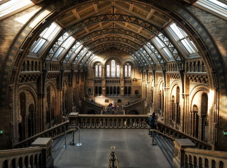
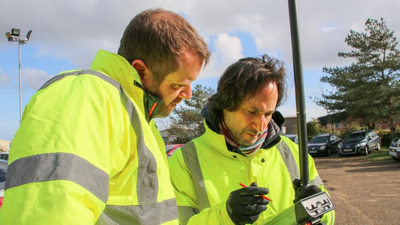
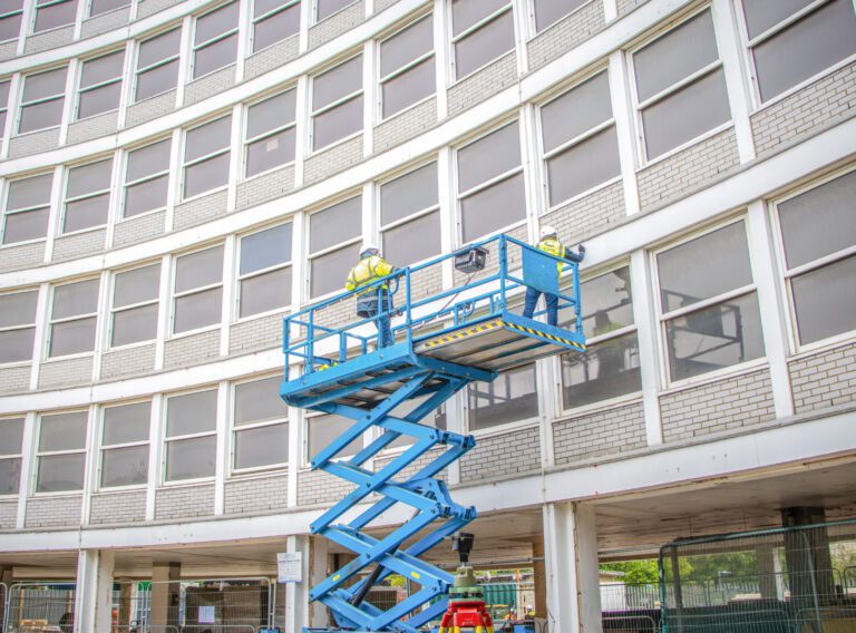
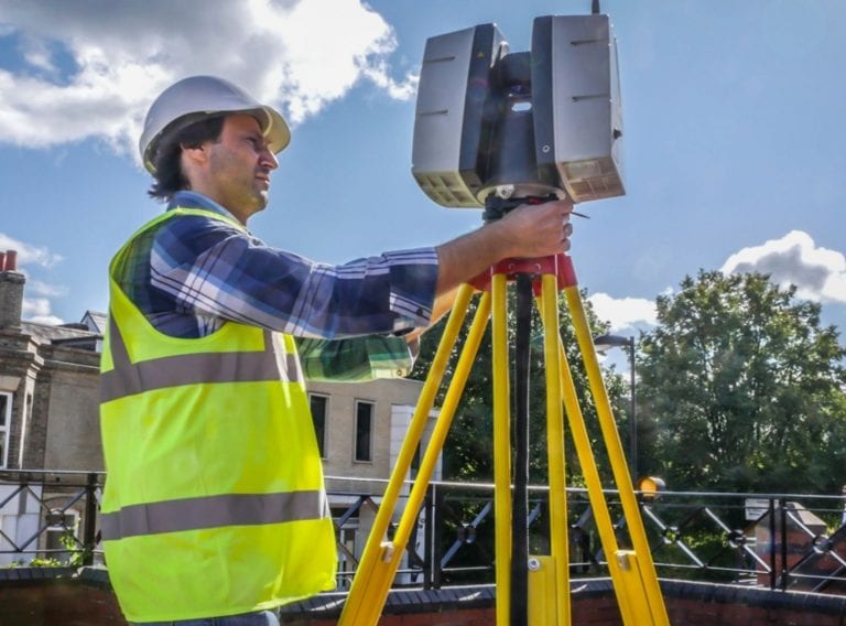
A measured survey is a dimensionally accurate representation of a site, building or structure that is captured using calibrated instruments such as Total Stations, laser measuring devices or 3D HD laser scanners. The site data is then translated into scaled 2D traditional drawings or 3D digital models and used for developing design proposals, preparing technical information, for construction or facilities management purposes.
A measured survey can include various levels of detail depending on the specified project requirements. As a minimum it would include levels, the building structure, walls, roofs, fenestration, doors and other openings, and can also include historic detail, rain goods and building services.
A measured survey provides dimensionally accurate and reliable information regarding the shape, size, structure and geometry of the building. Common reasons for requiring a survey include preparing planning proposals and applications, architectural and interior design, construction, or for asset records and facilities management purposes.
A measured building survey is an investment in knowledge and the information it provides offers certainty that can save on the initial investment many times over by reducing the opportunities for misunderstandings, misinterpretations, and errors.

Get the precise data you need to complete your next complex project.
Measured Building Surveys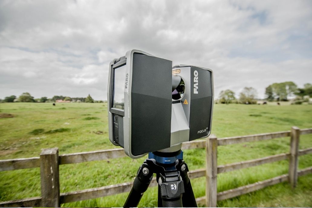
Increasingly, HD LIDAR (Light Detecting and Ranging) technologies such as laser scanners and aerial drones are used to capture site data reducing collection times. This increases accuracy and provides Point Cloud data giving a 3D digital representation of the measurement data improving the understanding of the building’s geometry, construction and layout.
The site data can be delivered in a Point Cloud digital file format, most commonly used to inform the preparation of traditional 2D plans, elevations and sections, but increasingly is being used to create ‘Digital Twins’ in the form of 3D models in Autodesk Revit software. The 3D option greatly improves the understanding of the as-built building condition and enhances the co-ordination of the design process, identifying potential issues such as clashes at the modelling stage so eliminating potentially costly errors in the design.
Measured surveys are priced based on the time required to comprehensively capture the site data, process the digital information and in preparing the required outputs. The price will vary depending on the type of building, its height, area, complexity of its construction, the internal layout and the extent of the data required to be captured by the survey. Prices range from under £5,000 to £70,000 plus depending on the above factors and how the survey information will be used.
Working on complex projects or multiple locations, our measured surveyors work across the UK and internationally.
Measured surveys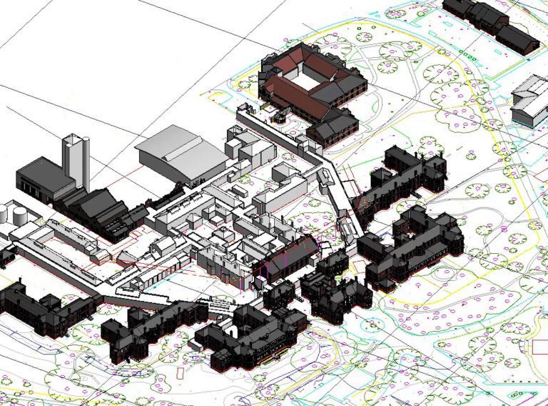
For your development project, receive accurate topographic surveys from our experts mapping the site, its features and topography.
Topographic surveys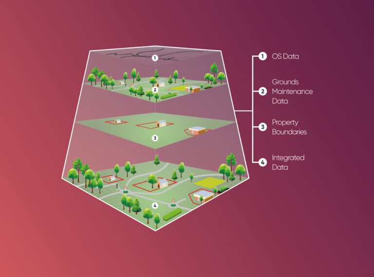
We provide cost and efficiency saving in asset management by helping clients create, maintain, update and analyse asset information within a Geographic Information System (GIS).
GIS & asset mapping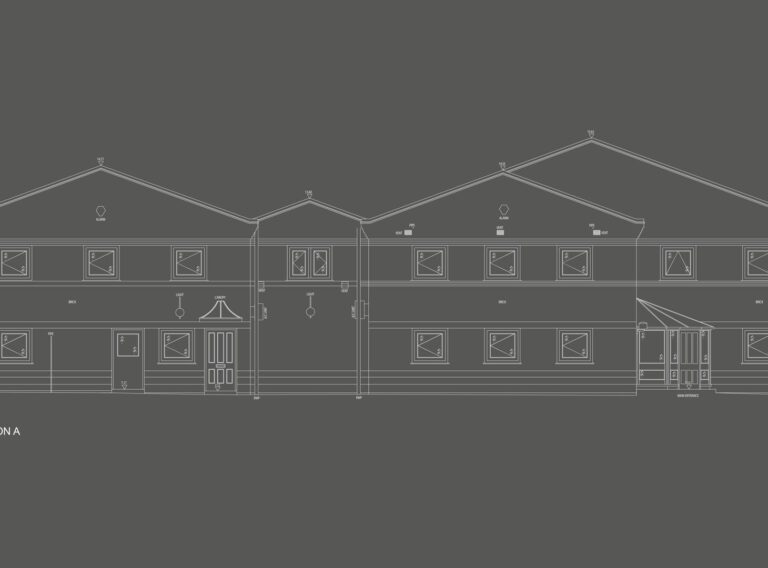 11/09/2023
Case Studies
11/09/2023
Case Studies
 05/06/2020
Insights
05/06/2020
Insights