Get accurate results with our 3D laser and point cloud surveys
Our highly experienced surveyors will conduct 3D laser or point cloud surveys to ensure you have all the spatial information and 3D modelling you need.
Laser surveys
This video case study explains how a detailed laser and topographic survey of the 25 acre Goodmayes hospital site was delivered as a LOD 300 model
Scroll
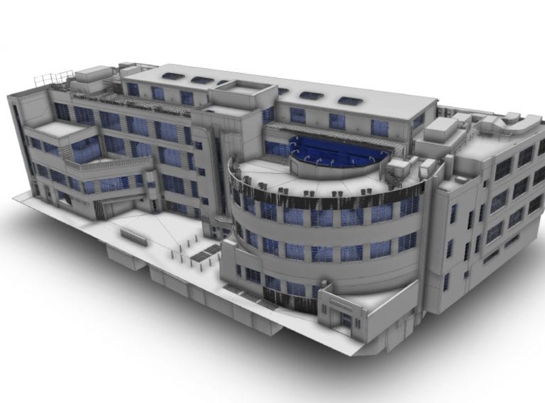
This major project involved a measured building survey of the 10 hospital buildings and 20 ancillary buildings on this 25 acre site. Our client, architects practice Ingleton Wood, required detailed scans of the external facades and for the survey data to be delivered as a 3d model.
We created the 3D model to various levels of development relating to how the architects were planning to use the data.
This included a LOD 300 model of the external elevations of the buildings in detail, as the architects were planning to preserve these elements. We also picked up the ancillary buildings to a conceptual level to give context to the site.
The scale of the project can be understood by the external traverse of the site which was 1,000 metres.
The 2.12-hectare site included a large supermarket and 26 retail units and an 18th-century historic mill.
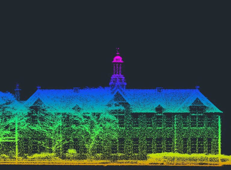
Read case studyWe used laser scanners to capture the details on the external elevations and within the vacant buildings. Where e the building was still in use, our surveyors used a traditional measured survey.
We took over 600 laser scans in total, amounting to over half a terabyte (500 gigabytes) and the biggest challenge was managing the data, registering the scans to bring it all together.
Our comprehensive survey department has specialists in different areas including experienced site surveyors, expert 3D modellers and specialists in laser scanning and setting up control networks.
The key to this project was how we linked the different sources of data including GPS, Total Station, laser scanning and manual hand measurements.
To read the case study in full, please visit Goodmayes Hospital Project.
Our highly experienced surveyors will conduct 3D laser or point cloud surveys to ensure you have all the spatial information and 3D modelling you need.
Laser surveys
Receive highly accurate Revit® building models which ensure the success of your BIM (Building Information Model) project.
Revit models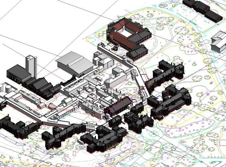
For your development project, receive accurate topographic surveys from our experts mapping the site, its features and topography.
Topographic surveys