Receive accurate and reliable measured surveys for your building project
Working on complex projects or multiple locations, our measured surveyors work across the UK and internationally.
Measured surveys
The apprenticeship will give individuals the skills & training to analyse geospatial data using leading edge digital technology, such as 3D laser scanning
Scroll

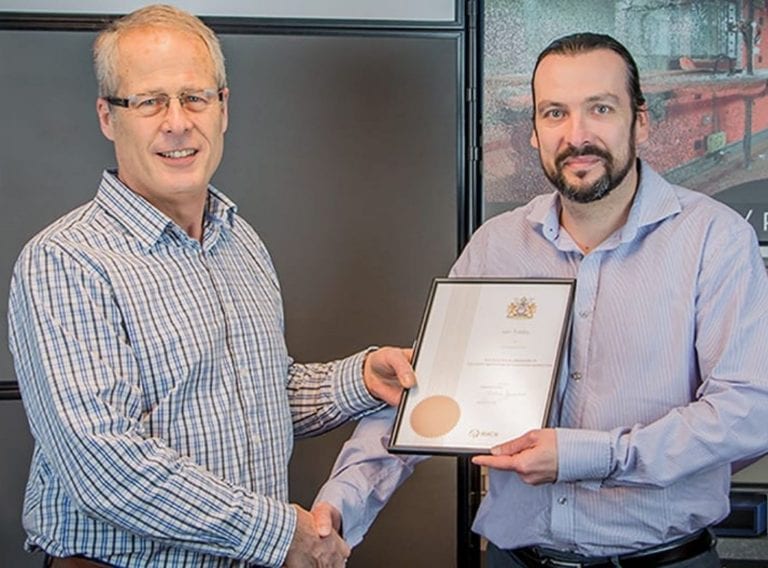
CADS is one of a handful of companies in the East of England to recruit an apprentice for the new Geospatial Technician Apprenticeship.
The apprenticeships will give individuals the skills and training to analyse geospatial data using leading edge digital technology, such as 3D laser scanning.
The Secretary of State for Education Damien Hinds gave the go ahead for the geospatial apprentices in March this year.
Elliot Brooks, was recruited by Gapton Hall based CADS to undertake the Level 3 apprenticeship over the course of two years. The training will be a combination of on-the-job training and formal learning modules delivered by Dudley College in the West Midlands.
Rated Outstanding by Ofsted, this is the first year the college has offered the new Geospatial apprenticeship scheme, taught from its Centre for Advanced Building and Environmental Technologies.
The geospatial apprenticeship was developed by a group of 19 employers, led by Skanska and supported by the Royal Institute of Chartered Surveyors and the Chartered institution of Civil Engineering Surevyors.
Image: Dudley News

Elliot Brooks, CADS Geospatial Apprentice said:
“In the short time I’ve been with CADS, I’ve visited project sites with my surveying colleagues and have seen first hand the type of skills required and the equipment used for jobs. I’m really looking forward to completing the apprenticeship and starting my geospatial career.”
Iain Tubby, principal surveyor of C A Design Services at CADS said:
“It’s a really positive move for the GIS and surveying sector. We’ve found it challenging to fill vacancies because of the national skills gap, however this apprenticeship will help bring through the next generation of geospatial professionals to deliver future projects in the region.”
Discover more about careers at CADS.
CADS' CareersDudley college has invested heavily into providing brand new training facilities to support modern construction techniques in the last two years. This has enabled us to deliver new apprenticeship standards such as the Geospatial Survey Technician apprenticeship course which was launched earlier this year. Our efforts have been well received and it is rewarding to see that our state of the art facilities are being utilised not just by our local market but by modern construction businesses nationwide.
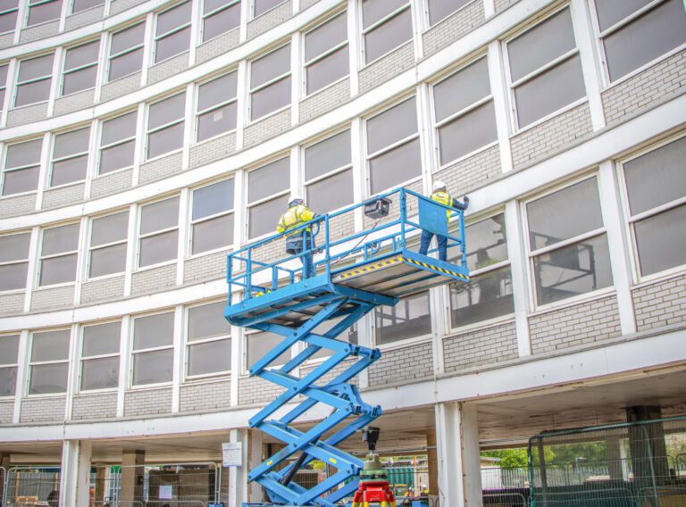
Working on complex projects or multiple locations, our measured surveyors work across the UK and internationally.
Measured surveys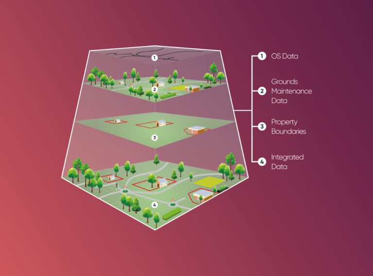
We provide cost and efficiency saving in asset management by helping clients create, maintain, update and analyse asset information within a Geographic Information System (GIS).
GIS & asset mapping