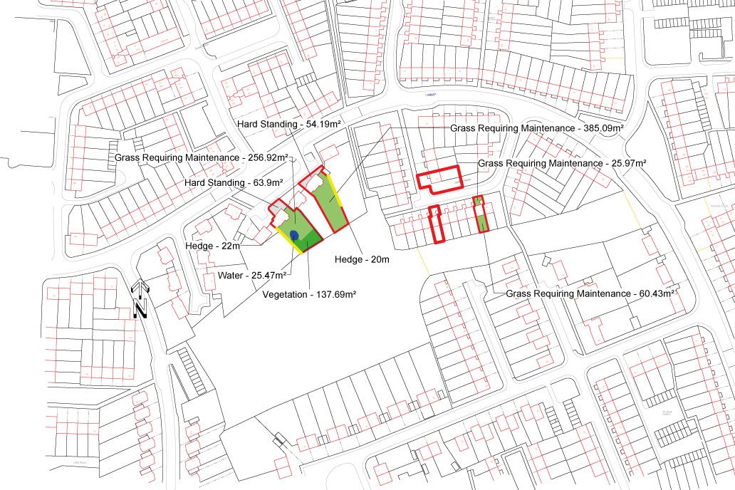
Creating base data by scanning & digitising historic information
Our cartographer created the base data for the project by scanning historic plans to create digital plans of the properties using Cadcorp GIS software. Where available relevant information was added as attributes to the plans – such as areas of ‘grass requiring maintenance’, property boundaries, hedge lengths and required heights etc.
A physical visit and survey of each site was the next stage of the project. The surveyors verified what information was correct, updated it where it wasn’t and added/amended features that were required. This data was then updated using consistent styles across all plans.