Receive accurate and reliable measured survey services for your building project
Working on complex projects or multiple locations, our measured surveyors work across the UK and internationally.
Survey services
Scroll

Here at CADS, we’re a leading supplier of surveying services for architects, project managers, building contractors and estate managers across the UK and internationally.
With over 30 years’ experience, we know the intrinsic value surveys bring to building design. So, we’re taking a look at the key surveys on the market and the many ways in which they can assist with the design process of construction projects.
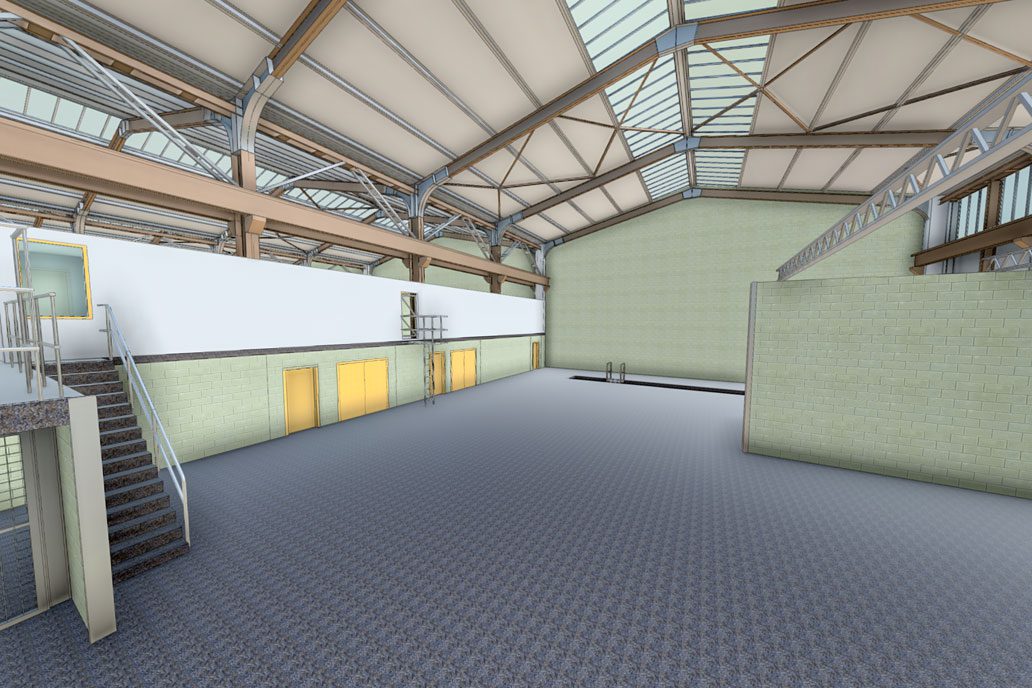
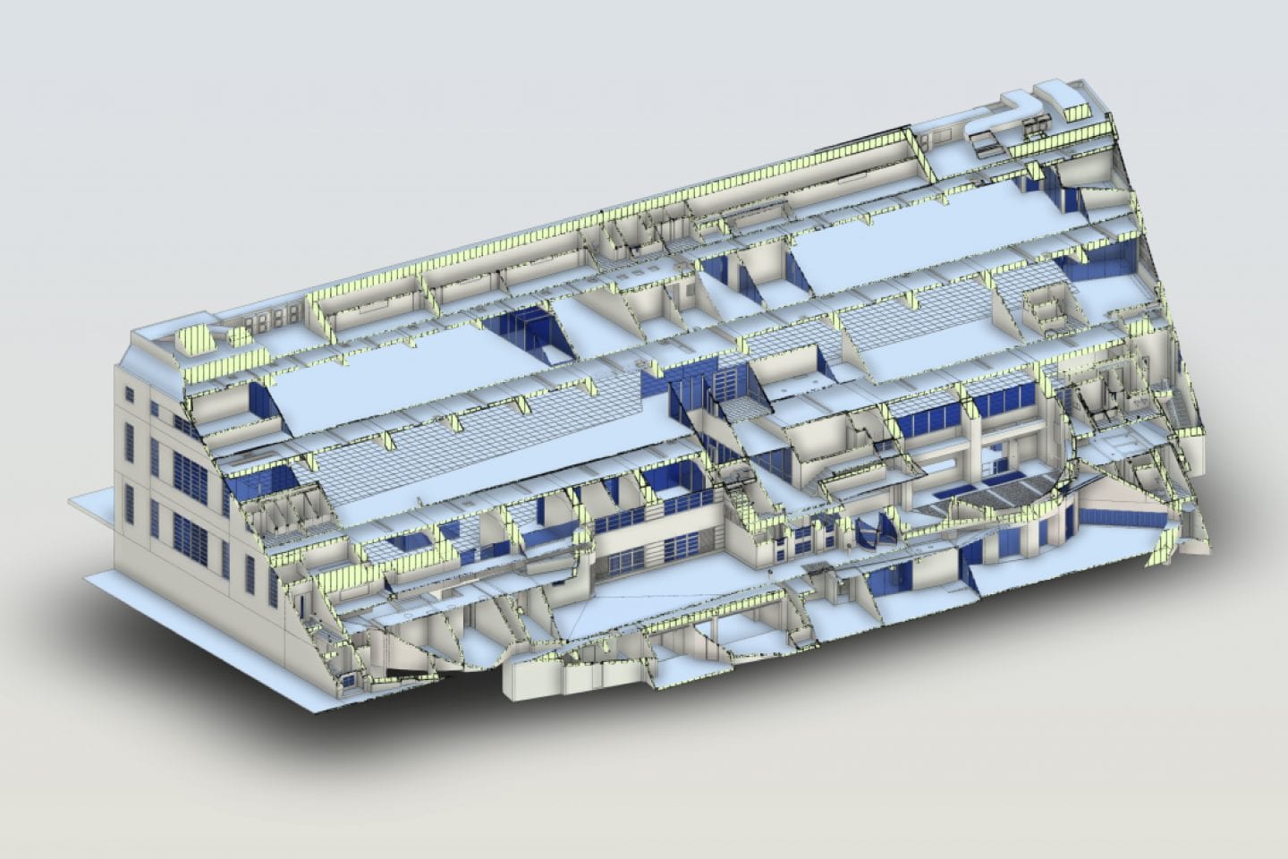
BIM (Building Information Modelling) surveys provide an accurate 3D model which architects and engineers can use as the foundation of their work.
Here at CADS, our expert team of surveyors work with our clients to create a BIM survey specification with the correct Level of Detail (LOD) for the project’s needs
A measured building survey captures accurate internal and external details of a building, resulting in deliverables such as 2D measured floor plans, sections and elevations and 3D models.
These can be used for making decisions on feasibility, design and planning for both new-builds and refurbishments.
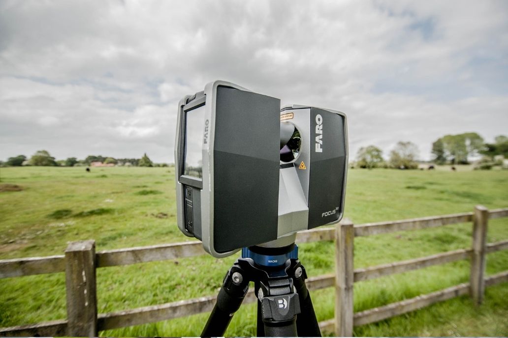
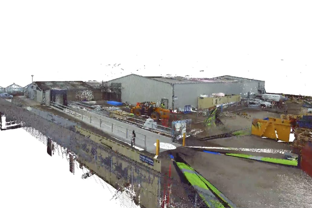
Laser surveying reveals the spatial details of a structure. Clients receive their survey data in the form of a 3D Revit® model or 2D CAD drawing as well as the registered point cloud data file.
These models or drawings can be produced quickly to ensure design work can commence as soon as possible, allowing architects and design teams to experiment, plan and record changes to their project.
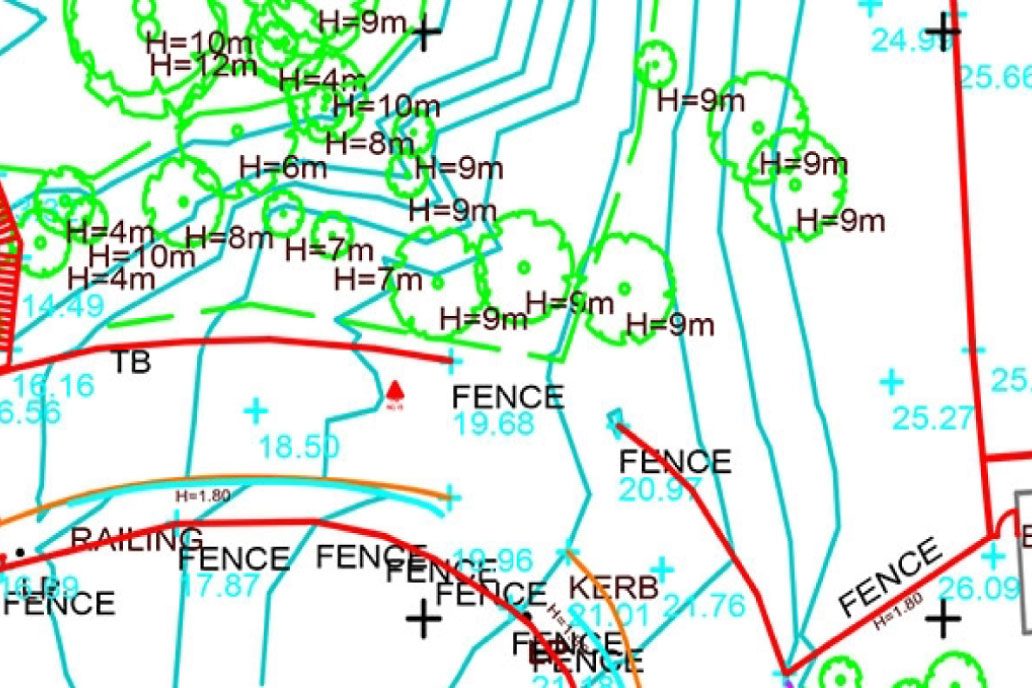
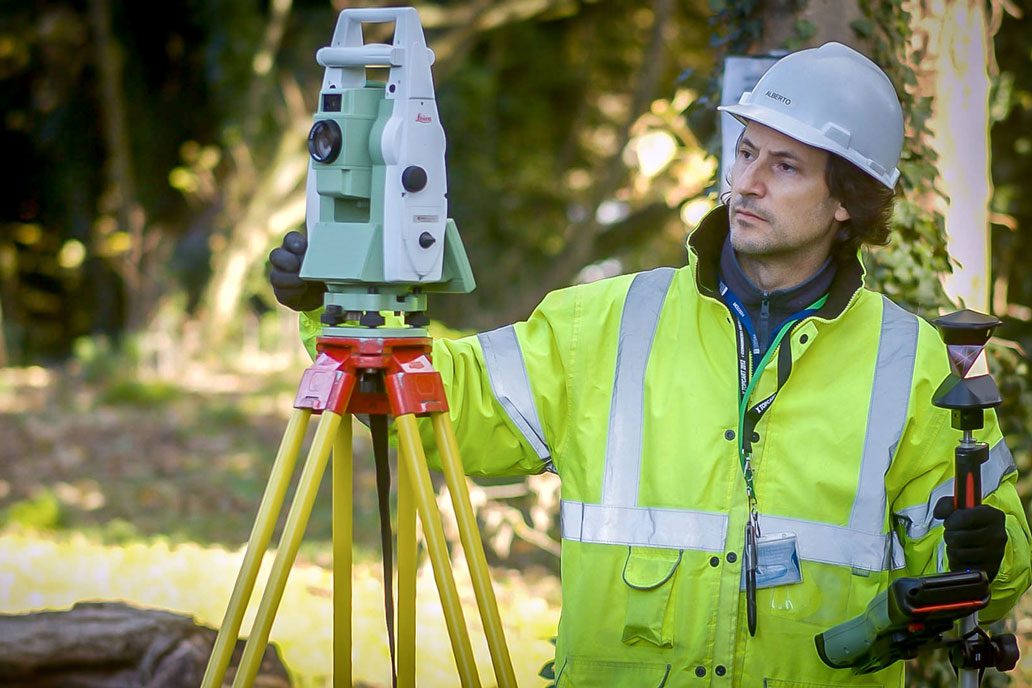
Using the latest GPS, Total Station and laser scanning measuring instruments, topographical surveys enable land mapping, providing details of the natural and man-made features of a site.
These surveys are often commissioned early in the construction process as a starting point for design and other decision-making.
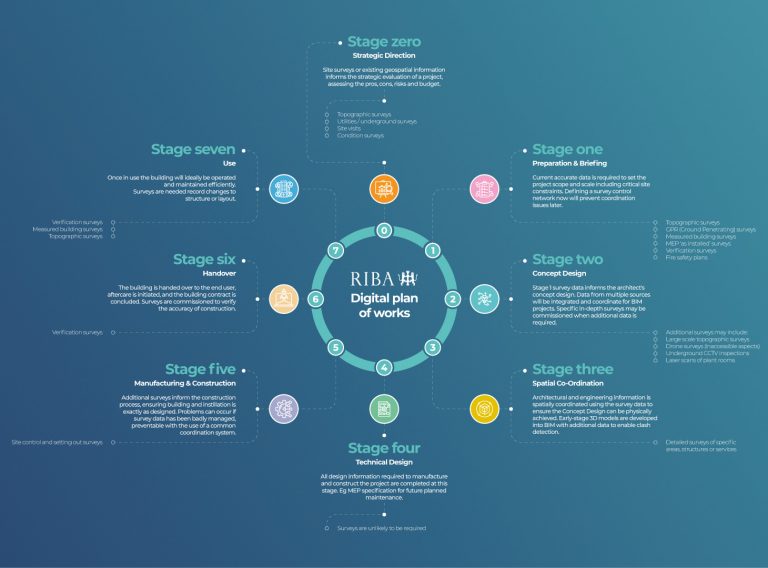
Perhaps most importantly, conducting a survey enables a project to follow the Royal Institute of British Architects’ (RIBA’s) Plan of Works.
RIBA’s Plan of Works is a model which features defined stages for the design and construction process.
Most surveys are commissioned at ‘Stage 0 – Strategic Definition’ or ‘Stage 1 – Preparation and Briefing’. These surveys are vital to making strategic decisions, evaluating risks and budget and outlining the scope and scale of the project.
Crucially though, the survey data which is captured at Stage 0 and Stage 1 will aid ‘Stage 2 – Concept Design’. The data is delivered to architects as a 3D model which enables them to make informed decisions on the form, scale and general appearance of their design. So, if a project is following RIBA’s Plan of Works, a survey is vital for the design process. In fact, the design stage cannot be achieved without it.
Architects can then move their design through the remaining stages of the construction plan to completion.
Watch our video which explains the vital survey data considerations required to align with the RIBA Digital Plan of Works.
Watch video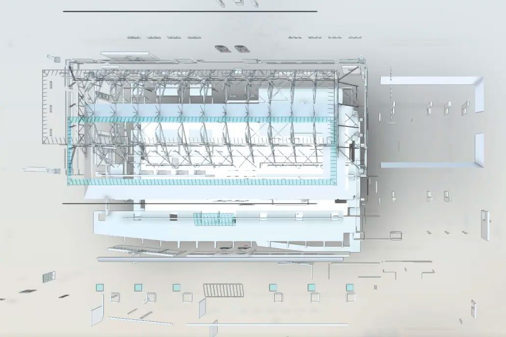
For many architects and designers, point cloud files or 3D models created from survey data become the foundation of their designs.
A point cloud file verifies the details of the site, providing a valuable visual resource and precise dimensions which can be used to make informed decisions at the beginning of the design process.
A 3D model goes even further, often acting as the starting point of the design. It enables architects to work within a virtual 3D environment, allowing the creativity of the design process to flow as ideas are trialled, bringing concepts into reality.
This is indispensable when making design choices – including experimenting with ideas led by current trends in the construction industry.
For example, incorporating biodiversity and biophilia into building design is a growing trend, particularly as the world pays more attention to environmentalism.
Designers are increasingly adding elements of the natural world into their buildings, considering sunlight and fresh air flow as well as introducing pot plants, green walls, aquariums and sensory gardens.
A virtual model of a project will allow architects to take this into consideration throughout their design process.

One of the main benefits of commissioning a survey is the accuracy of the resulting data – which is key for the design process.
The accuracy of the survey data and resulting deliverables enables architects and their teams to take on the design process with the assurance that all decisions made are based on correct site information.
Having access to this information means any design issues or errors can be identified and rectified as soon as possible, therefore avoiding potential reworks later on in the construction process.
This significantly minimises risk throughout the project, particularly if a survey is conducted early in the process.
Regardless of the size or complexity of a construction project, the building design process often involves multiple stakeholders which are required to work collaboratively.
With 2D and 3D models providing an easy-to-use visual medium, survey data can facilitate effective collaboration and coordination between all participants of a project – especially as they can work digitally.
Plus, there is an opportunity to integrate all data into a single environment, making the design process – and the whole construction process – run more efficiently and effectively.
To conclude, surveying in architecture projects – and receiving the resulting data – is vital to the design process.
As well as forming the foundation of the design, survey data can help architects assess risk to reduce design issues, while ensuring smooth collaboration and co-ordination with other key players in the project.
Plus, it allows architects to follow RIBA’s Plan of Works which helps the design process – and the whole project – stay on plan.

Get the precise data you need to complete your next complex project.
Measured Building Surveys
Here at CADS, our team of expert surveyors are on hand to advise on the best survey solution for each project.
We work with architects, project teams and building contractors, efficiently and effectively conducting a wide range of different survey services for a vast array of projects.
We’ve worked on projects across the UK and the rest of the world, with the expertise, skills and knowledge to deliver fast, reliable and accurate data which adds value to the whole construction process.
Get in touch today to find out more about how our surveying services can benefit your building project.
Get in touch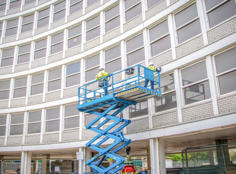
Working on complex projects or multiple locations, our measured surveyors work across the UK and internationally.
Survey services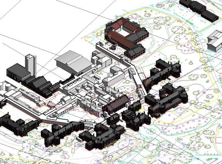
For your development project, receive accurate topographic surveys from our experts mapping the site, its features and topography.
Topographic surveys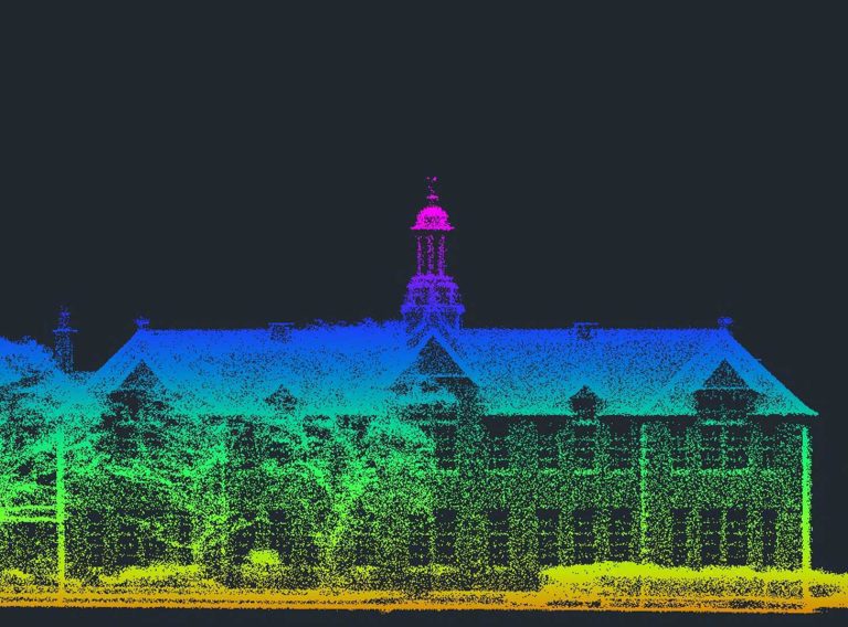
Our highly experienced surveyors will conduct 3D laser or point cloud surveys to ensure you have all the spatial information and 3D modelling you need.
Laser surveys