The role of topographic surveying in Biodiversity Net Gain

Is your next property development aligned with the latest 10% biodiversity net gain legislation? Begin with a Topographic Survey today!
Scroll

BNG legislation enables a superior natural habitat
Will your next property development meet the latest 10% Biodiversity Net Gain legislation? Commissioning a topographic survey is an ideal starting point for gathering the necessary supporting data for a Biodiversity Net Gain (BNG) assessment.
Is a BNG assessment essential?
In England, BNG is mandatory under Schedule 7A of the Town and Country Planning Act 1990 (Schedule 14 of the Environment Act 2021). The government will require small developments to comply from April 2024 and developers of nationally significant infrastructure projects from late November 2025. The purpose is to ensure developers establish a superior natural habitat on the site throughout the development process, when compared to its pre-development state.
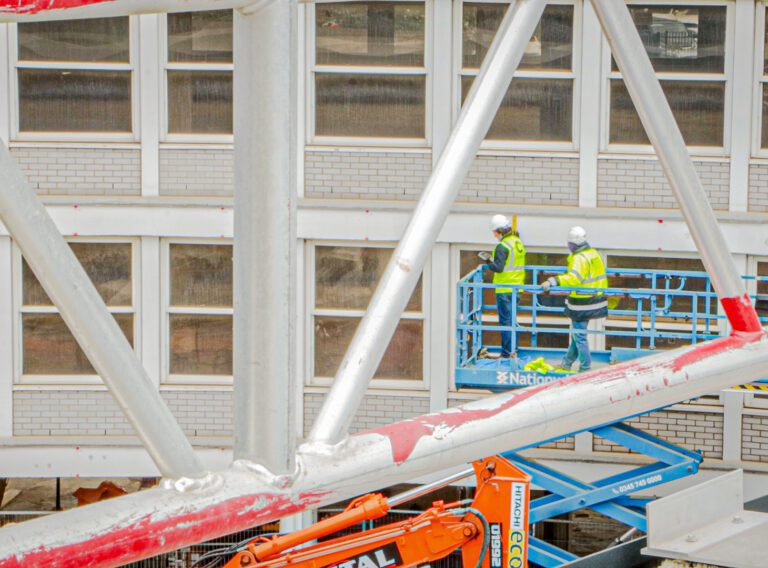
Property development and environmental impact
Biodiversity Net Gain is a key principle in sustainable development, ensuring that construction projects not only minimise harm but actively contribute to restoring and improving the environment.
Whereby Topographic surveys play a crucial role in providing detailed data on the physical features of a landscape, essential for assessing and planning the ecological net gain of a development project. This article looks at how topographic surveying is vital to understanding biodiversity and providing an overall net gain.
Understanding Biodiversity Net Gain
BNG requires developments to enhance biodiversity and contribute positively to the natural habitat and ecological features of the area. This approach encourages sustainable development and promotes a resilient ecosystem.
BNG includes –
- Preservation of species: Ensuring a variety of plant and animal life is maintained or enhanced.
- Ecosystem services: Supporting the natural processes that provide clean air, water, and pollination of crops.
- Climate change mitigation: Contributing to carbon storage and flood risk reduction.
- Social benefits: Improving human well-being through increased access to natural spaces and recreational areas.

Legislative Framework
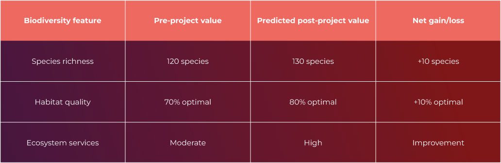
BNG legislation is crucial for evaluating global environmental impact of developments, with governments integrating requirements to minimise biodiversity impact and promote improvements. Effective implementation depends on clear, measurable criteria for consistent assessment and monitoring throughout legislative stages, including biodiversity identification, impact assessment, mitigation, enhancement strategies, and results reporting. The table illustrates a simplified example of how biodiversity metrics might be quantified before and after a project.
It is essential to use a consistent and transparent methodology to ensure that the environmental net gain is not only targeted but also delivered and maintained over the long term.
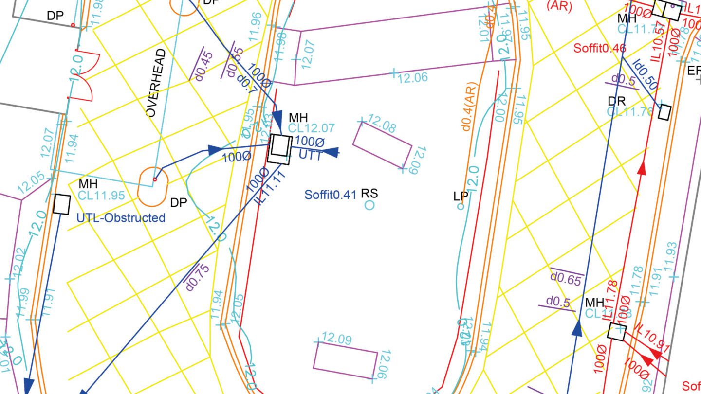
Topographic survey for major Norfolk hospital: Queen Elizabeth Hospital
CADS Survey provided topographic & utilities detection surveys for the Queen Elizabeth Hospital in King’s Lynn, assisting ongoing development plans.
Read this articlePrinciples of Topographic Surveying
Topographic surveying determines Earth’s surface points, distances, and angles for precise terrain mapping, aiding accurate environmental management and development planning. It involves measuring three-dimensional coordinates, ensuring accurate location determination.
The data collected is vital for applications like urban planning, infrastructure development, and biodiversity net gain assessments, providing a baseline for current conditions and a reference for future changes. Read a more detailed description here – Understanding what is included in a topographical survey.

Techniques and Technologies
Topographic surveying has advanced significantly with the advent of new technologies, each offering different advantages in assessing biodiversity net gain –
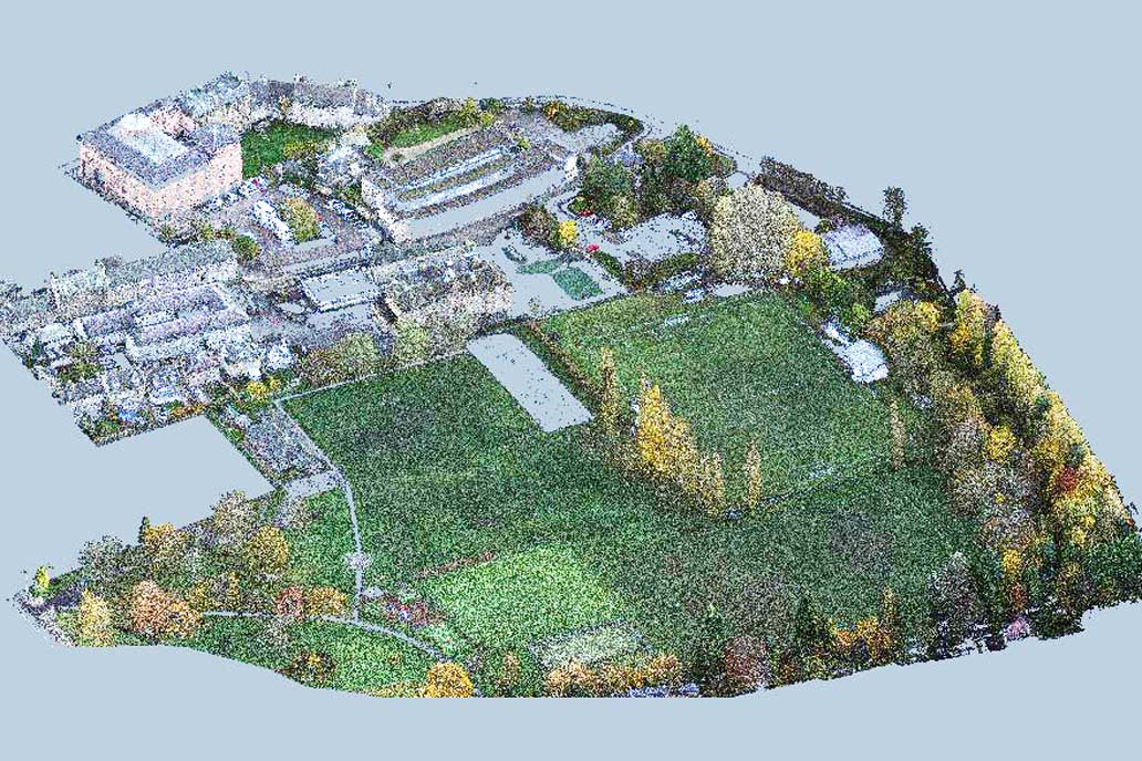
- Laser scanning captures complex terrains providing high-resolution data
- GPS ensures precise location mapping
- GIS integrates various data types for analysis
- Drones and Unmanned Aerial Vehicles UAVs offer aerial perspectives in remote areas
- LIDAR penetrates dense vegetation by emitting light pulses to create detailed 3D landscape models.
The choice of technique depends on project scale, terrain complexity, and detail requirements. These technologies not only enhance topographic survey accuracy, they reduce the time and labour required for fieldwork, making it possible to monitor changes in biodiversity over time with greater efficiency.
Data Interpretation and Mapping
After data collection, the interpretation and mapping phase converts raw data into actionable insights for biodiversity conservation. Topographic maps assist stakeholders to visualise land use planning, habitat restoration, and achieving biodiversity net gain.
Conclusion
In conclusion, long-term monitoring is crucial for tracking success, adapting strategies, and maintaining biodiversity net gain. CADS Topographic surveys play a pivotal role, providing detailed data for informed decisions balancing development with habitat preservation and BNG legal requirements. Integrating topographic data with ecological expertise promotes responsible land management, biodiversity conservation, and commercial success.