Drone land surveys
Map the natural physics and features across vast sites with a fast and cost-effective UAV drone survey from CADS.
Drone Land Surveys
Using a drone to conduct a land survey has become increasingly popular in recent years. Due to a wide range of benefits associated with its use, drone surveying is an extremely useful tool for many projects.
Scroll
Here at CADS, we’re specialists in providing accurate and reliable surveying services for a wide range of building and landscaping projects. Following the rising demand, we have recently added drone land surveys to our extensive repertoire.
We’ve taken a look at how drone land surveys work, what they are used for and their many benefits.
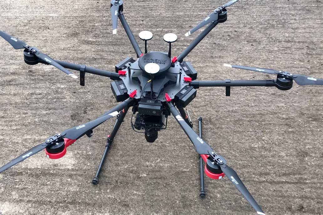
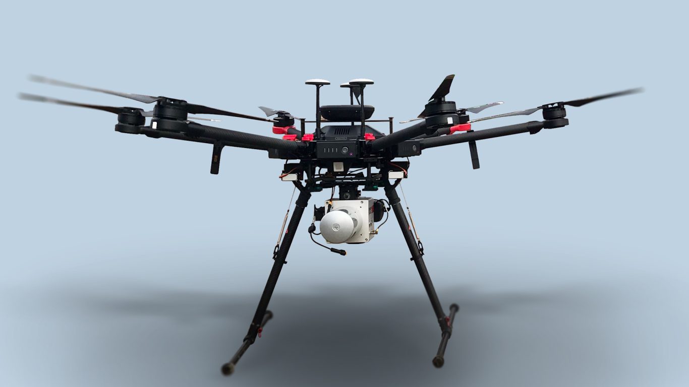
Drones are also known as unmanned aerial vehicles (UAVs).
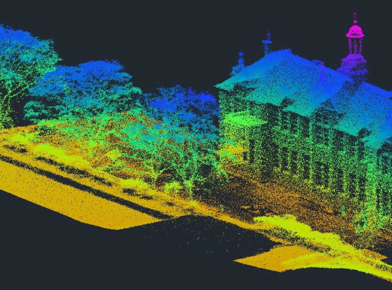
When used for conducting a survey, they capture aerial data using a LiDAR scanner and data capture sensors which are mounted to the drone. The scanner produces a laser pulse which collects ground measurements by working out the time it takes for the beam of light to hit the ground and reflect back.
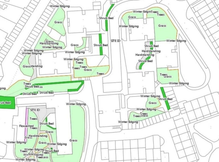
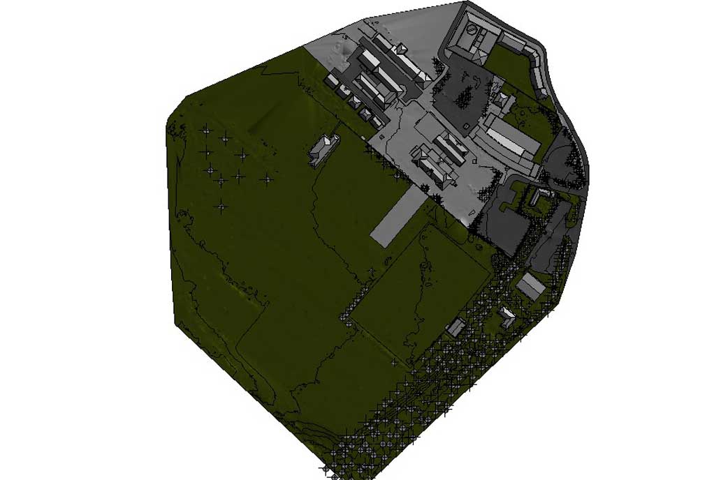
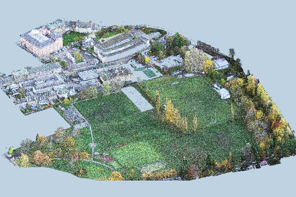
Multiple photographs are taken of the land below in order to piece together a full picture of the space. This maps natural and physical features, contours and elevations on a site.
Using the captured data, a number of deliverables can be produced. This includes both 2D and 3D formats, such as land survey drawings and digital terrain models. These are useful for providing an accurate digital representation of existing architecture and topography.
Crucially, all drone surveys must be undertaken by a person or company which is licensed by the Civil Aviation Authority (CAA). Although drones fly at a lower altitude than manned aircraft, users must still follow UK aviation regulations.
There are a number of projects that aerial drone surveys can be used for, such as:
Ideal for gathering data about natural and man-made sites, as well as both small and large land areas, a drone survey is well-suited to topographic surveys.
A drone survey enables quick access to hard-to-reach rooves for inspection, therefore removing the need for time-intensive work and costly equipment.
For efficient monitoring of the on-site progress of a construction project, a drone survey can be used as a quick way to get as-built data.
A drone survey can capture photogrammetry to produce high-resolution orthomosaics which enable digital visualisation of small and inaccessible areas.
Ideal for helping to ensure BREEAM (Building Research Establishment Environmental Assessment Method) compliance, drone surveys can be used for infrared thermal detection and thermal imaging on a building or construction site.
Drone surveys have numerous benefits which make them a very valuable survey solution for many projects. These include:
Using a drone for a land survey is a quick and easy way to obtain data. This makes the surveying process more time effective than other methods such as terrestrial surveys.
Whereas a traditional topographic survey might involve two surveyors spending a week on site to collect the data, a drone survey can achieve the same results in a few hours, even on larger sites.
Also, with the data collected faster, plans and models can be created and delivered sooner, resulting in the quick turnaround time that many clients look for.
As a drone survey is much quicker and significantly less labour intensive than other surveying methods, it is much more cost effective.
The time in which a drone survey can be conducted means that less field time and manpower is required. This cuts the labour costs so the same survey data can be collected and delivered at a much lower price overall.
With use of a drone, previously inaccessible or hazardous areas can be more easily and safely reached.
Whilst there are some restrictions, such as use in densely packed areas or during adverse weather conditions, drone surveys can operate in most locations. This means that harsh terrain and unreachable areas can be captured relatively easily.
Drone surveys are conducted in the air, meaning they cause much less disruption than other types of surveys.
While other survey methods require significant time spent on the ground at a location, drone surveys can be undertaken almost unnoticed, making them a less intrusive survey solution.
The quality of drone and camera technology has improved rapidly in recent years. A drone and scanner can capture thousands of measurements to create an accurate digital representation of a physical space.
As a result, the data collected from a drone survey is now very precise.
Using a drone for a land survey is a quick and easy way to obtain data. This makes the surveying process more time effective than other methods. Whereas a traditional topographic survey might involve two surveyors spending a week on site to collect the data, a drone survey can achieve the same results in a few hours, even on larger sites. Also, with the data collected faster, plans and models can be created and delivered sooner, resulting in the quick turnaround time that many clients look for.
Here at CADS, we work with our aerial drone survey partners to offer accurate and reliable data from drone surveying.
Our team of surveyors are highly experienced in conducting efficient and effective surveys for a wide range of clients across the UK and beyond.
As well as our drone survey service, we provide a wide range of other surveys for architects, project managers, landlords, estate managers, design teams and building contractors. These include traditional topographic surveys, laser surveys, GIS and asset mapping and more.
Our expert team are on hand to advise you on the most suitable survey for your project.
Get in touch today to find out more.
Contact us
Map the natural physics and features across vast sites with a fast and cost-effective UAV drone survey from CADS.
Drone Land Surveys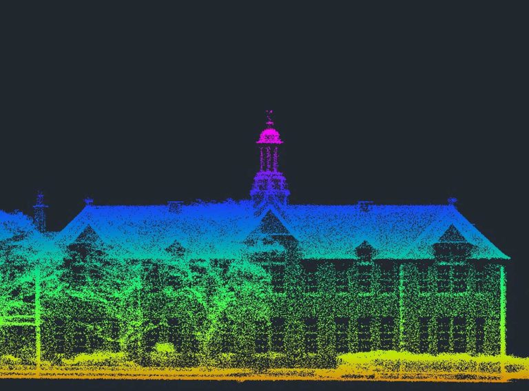
Our highly experienced surveyors will conduct 3D laser or point cloud surveys to ensure you have all the spatial information and 3D modelling you need.
3D laser surveys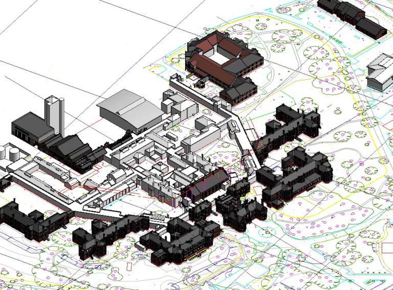
For your development project, receive accurate topographic surveys from our experts mapping the site, its features and topography.
Topographic surveys