Drone land surveys
Map the natural physics and features across vast sites with a fast and cost-effective UAV drone survey from CADS.
Drone land surveys
As a leading supplier of survey solutions for a wide range of projects, we’ve discussed applications of drone surveys for you as an architect – and the top three reasons you should commission one for your next project!
Scroll
Drone surveys have greatly improved the way architects work, by offering an efficient way to collect data.
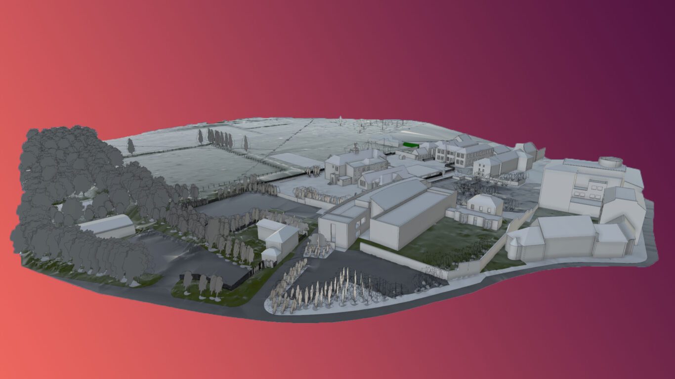
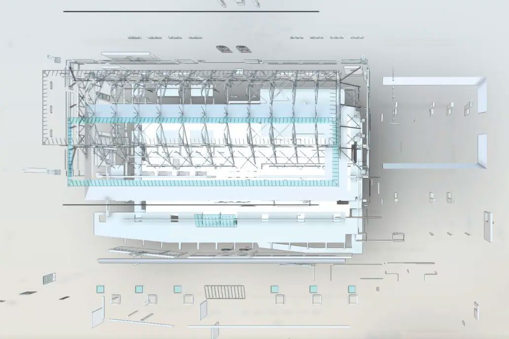
They capture high-resolution images and videos of key areas, which can be used to create 3D models of sites and buildings. These can be used for a variety of purposes, including design, planning, and construction.
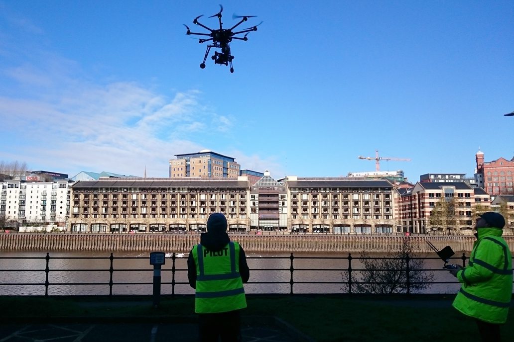
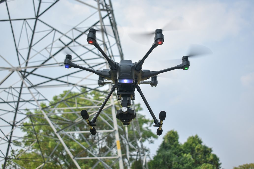
Drone land surveysDrone surveys – or unmanned aerial vehicles (UAVs) – are increasingly being utilised in the surveying industry!
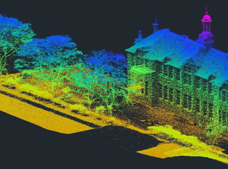
Using an LiDAR (light detection and ranging) scanner and attached sensors, they collect dimensionally accurate aerial point cloud data of the ground below to provide an exact representation of the area.
Drone surveys add significant value to many architectural projects and are often a quick way to obtain accurate data of both accessible and inaccessible areas with minimal disruption – at relatively low costs!
Generating both 2D and 3D deliverables from the data, drone surveys are extremely versatile for a range of projects.
Drone surveys can be extremely useful for many projects, but they can be a very a valuable tool for architects! Here are some of the ways they can be used:
There are many different ways architects can benefit from a drone survey, but let’s look at the top three:
One
With high-resolution imagery, video and accurate point cloud data, drone surveys produce a precise representation of your site, which can support you with the design process. This can help you to follow the Royal Institute of British Architects’ (RIBA’s) Plan of Works – a model which defines the key stages for the design and construction processes. The accurate data from a drone survey can inform RIBA Stages 1 – Preparation and Brief, 2 – Concept Design, 3 – Spatial Coordination and 4 – Technical Design, improving your overall design certainty.
Two
Dimensionally accurate photogrammetry and aerial LIDAR land and building surveys provide intelligence on existing layouts, designs, architectural features and construction. This information can reduce site visits and subsequently improve the efficiency of the design and construction process. Plus, this can help architects understand the site’s characteristics – crucial for designing visually appealing structures which integrate seamlessly into the environment.
Three
Commissioning a drone survey can provide you with accurate digital twins, like a 3D Revit model of a building. This can help you gain invaluable insights into the existing status and condition of development areas, such as accurate recordings of heritage sites, which can help with renovation and redesign.
Here at CADS, our aerial drone survey team work alongside your architectural project team to bring you accurate and reliable data.
With over 40 years’ experience, our expert team of surveyors have conducted efficient and effective surveys for a variety of clients in wide range of sectors.
As well as our drone survey service, we provide many other surveys for our clients, including traditional topographic surveys, laser surveys, GIS and asset mapping and more.
To find out more about how we can help you, get in touch today.
Get in touch
Map the natural physics and features across vast sites with a fast and cost-effective UAV drone survey from CADS.
Drone land surveys