Avoid project delays with our experienced measured surveyors
Our 40 years of experience provides us with great expertise, skill and knowledge about site survey services and building projects.
Working with us means that our expert team with relevant experience will handle your project so you can get the data needed to build an information model and focus your time on creativity or management.
We get the data right the first time and provide efficient delivery with a commitment to your working timescale. Keeping to timescales allow you to avoid rising costs, reworking your project and delays.
Measured Building SurveysRichard Griffiths, Director, Savills
The CADS team efficiently conducted a laser scan survey, ensuring minimal disruption to our operational building. The quick turnaround to provide the deliverables was impressive. I would recommend their services for any project requiring reliable and precise building data.
Professional Measured Building & Land Surveys for Construction Projects

Measured Building Surveys
Accurate surveys for design, planning, and refurbishment.
Floor Plans
Detailed layouts of each floor, showing walls, doors, windows, and key structural features. These plans provide the foundation for architectural design, renovation projects, and property management.
External & Internal Elevations
High-accuracy drawings capturing the character and dimensions of both façades and interior walls, ideal for planning applications, conservation work, and refurbishment projects.
Sections
Vertical cut-through views of a property that reveal its internal structure, ceiling heights, and key relationships between floors, supporting design and engineering decisions.
Reflected Ceiling Plans
Clear documentation of ceiling layouts, including lighting, HVAC components, and decorative features, essential for MEP planning and interior fit-outs.
Roof Plan Surveys
Precise surveys of pitched and flat roofs, recording all elements for maintenance, structural assessments, or redesign projects.
Measured Building SurveysProfessional Land Surveys
Comprehensive land and site data for planning and development.
Topographic Surveys
Detailed mapping of ground levels, site features, and boundaries, giving architects and planners accurate data for design and land development.
Utilities Mapping (GPR) Surveys
Non-intrusive detection of underground utilities using Ground Penetrating Radar, helping reduce the risk of damage during excavation or construction.
Desktop Utility Statutory Records Search
Researching and collating existing utility records to support early-stage planning and identify potential service constraints.
Professional Land Surveys

3D Laser Scanning Surveys
High-precision 3D data for modelling, verification, and digital records.
Terrestrial Laser Scanning
Ground-based laser scanning that captures millions of data points to produce highly accurate point clouds for design, analysis, and documentation.
Aerial (Drone) Surveys
Drone technology provides rapid, safe, and cost-effective surveying for large or difficult-to-access areas, ideal for construction, land, and asset management.
Construction Verification
Comparing as-built data to design models to ensure accuracy, highlight discrepancies, and support quality assurance processes.
Floor Flatness Surveys
Measuring and assessing floor levels to ensure they meet required tolerances, critical for warehouses, factories, and precision facilities.
Point Cloud Deliverables
Comprehensive 3D datasets compatible with CAD and BIM, enabling highly detailed modelling and seamless project integration.
Matterport Surveys
Immersive 3D walkthroughs and digital twins of buildings, providing an interactive way to view, share, and manage spaces.
3D Laser Scanning SurveysBIM Services
Intelligent 3D modelling for better design coordination and project efficiency.
Revit® Architecture Modelling
Detailed Revit models capturing every architectural feature, supporting visualisation, planning, and collaboration across project teams.
Revit® MEP Modelling & Design Coordination
Coordinated mechanical, electrical, and plumbing models to identify clashes and streamline installation on site.
Clash Detection
Early identification of design conflicts between different building systems to reduce rework and construction delays.
BIM Services

Engineering Surveying
Precision surveying to support engineering workflows, from infrastructure to high-spec commercial projects.
Setting Out Surveys
Translating design data into accurate site markings, ensuring structures are built exactly to plan.
Building Façade Surveys
High-resolution surveys for detailed façade mapping, invaluable for restoration, maintenance, or design projects.
Engineering SurveyingGIS Services
Smart mapping and data capture for infrastructure, planning, and asset management.
GIS Mapping
Bespoke maps that visualise geospatial data, supporting strategic planning and asset management across sectors.
GIS Data Capture
Gathering and processing site-specific geospatial data for use in GIS systems, analysis, and reporting.
GIS Services

Legal & Regulatory Surveying Services
Surveys to meet compliance and support legal processes.
Land Registry Compliance Plans
Accurate plans prepared to HM Land Registry standards for property registration or transfer.
Boundary Surveys
Surveys that clarify and document property boundaries, helping resolve disputes and avoid legal complications.
Net Lettable Area Calculations
Measuring lettable space in line with industry standards, supporting valuation, leasing, and property negotiations.
Rights of Light Surveys
Assessing and documenting daylight levels for planning applications and legal assessments.
Legal & Regulatory Surveying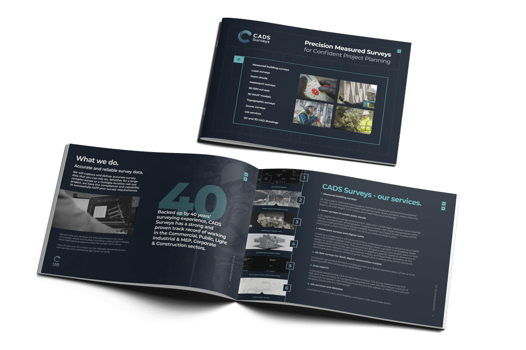
Who we work with


Ready to get your project started?
Design your best work with a team of technical experts behind you by speaking to one of our surveying experts today. We’re happy to help and answer any questions! Simply fill in the form and we will get back to you.