Get accurate results with our 3D laser and point cloud surveys
Our highly experienced surveyors will conduct 3D laser or point cloud surveys to ensure you have all the spatial information and 3D modelling you need.
Laser surveys
This video explains the benefits of a point cloud survey and how it can provide you with valuable information for your next building project.
Scroll
Whether you need to locate Mechanical and Electrical (MEP) services, verify existing drawings with what’s on-site or an ‘as-built’ survey before the strip-out works begin, commissioning a point cloud survey will give you the reliable information required.
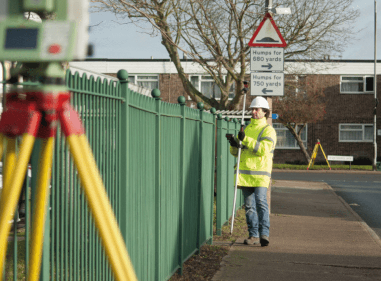
A point cloud survey captures the precise geometric detail of even the most complex structures. It captures them quickly and accurately and creates a valuable information tool for all members of the project team.
You only need to visit the project site once to create a point cloud survey. You can then use it as a cost-effective solution for a project requiring a phased delivery.
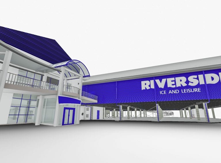
Project deliverables can include a 3D Revit® model, 2D plans as well as using the point cloud in isolation as an online site verification tool.
Delivered directly to your desktop as a raw file for importing into Revit® or via Faro’s interactive WebShare portal, the 3D point cloud has the benefit of bringing the site to life and aids collaboration.
Using a point cloud survey you can verify architectural details or to check specific measurements such as floor to ceiling heights, window and door spans or pipework in ceiling voids.
The Natural History Museum in London needed a better understanding of the commodities located within the retail space in their grand and historical building.
Approaching CADS, the Head of Retail requested measured surveys of the museum’s three permanent gift shops and storage areas so that configuration and product categories could be identified.
Read case studyDepending on your project requirements the point cloud can be produced in colour, black and white or a combination of the two. A coloured point cloud survey is easier to visualise with a real-life feel. The greyscale point cloud is colourised from site photographs taken on site.
For projects involving MEP works, you can easily identify the physically colour-coded pipes without reference to external images or drawings. The colour point cloud also brings historical sites to life – as if you are experiencing them in person.
It is, however, worth bearing in mind that the colour point cloud also captures the photographic images. This means the survey process takes longer on site and longer to register, which involves additional cost.
A black and white point cloud survey on the other hand is faster and therefore cheaper to deliver and suitable for most applications.
When creating a survey specification, we can identify specific areas needed in colour as opposed to black and white. This will ensure you get the optimum mix of data you need for your project.
Point cloud surveys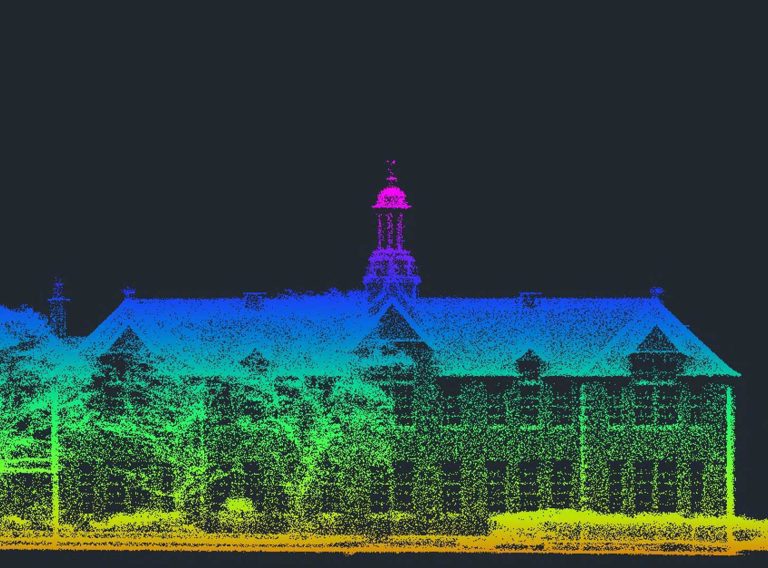
Our highly experienced surveyors will conduct 3D laser or point cloud surveys to ensure you have all the spatial information and 3D modelling you need.
Laser surveys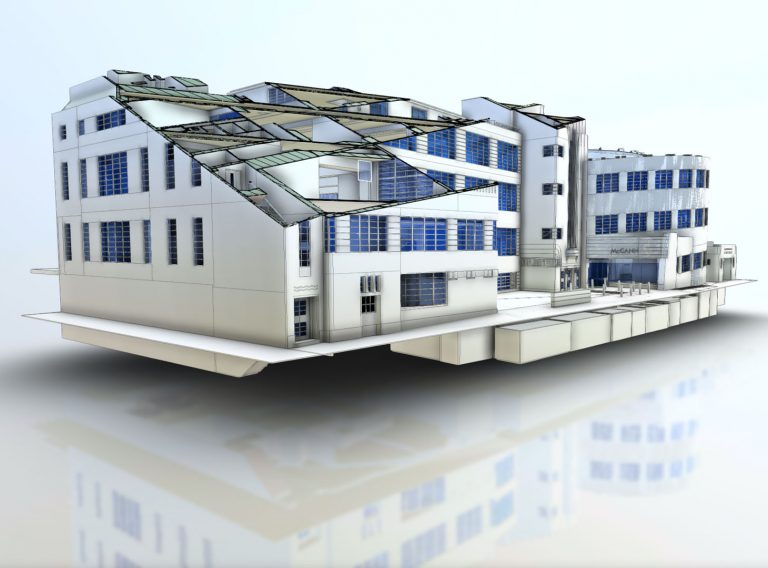
Receive highly accurate Revit® building models which ensure the success of your BIM (Building Information Model) project.
Revit models