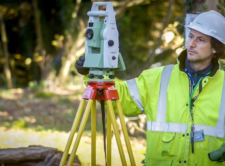
Get accurate results with our 3D laser and point cloud surveys
Our highly experienced surveyors will conduct 3D laser or point cloud surveys to ensure you have all the spatial information and 3D modelling you need.
Laser surveys
Elliot Brooks becomes one of the first students in the UK to complete the first geospatial technician apprenticeship, sponsored by CADS
Scroll

The surveying apprenticeship covers a variety of modules equipping students with the necessary skills for the job such as collecting geospatial data and geospatial technology. Enabling students to gain the necessary knowledge, skills and behaviour required by employers like CADS. Completing the apprenticeship will mean Elliot can apply to join a professional body such as RICS (Royal Institution of Chartered Surveyors) or CIES (Chartered Institution of Civil Engineering Surveyors).
We recruited Elliot to undertake the new Level 3 apprenticeship in 2018. This involved a combination of on-the-job training with our surveyors and formal learning modules delivered by Dudley College. Learning how to accurately collect geospatial data which is used in the creation of maps and the construction of infrastructure. The geospatial apprenticeship was developed by a group of 19 employers, led by Skanska and supported by the RICS and CIES.
Discover more about careers at CADS.
CADS' CareersElliot said:
“This apprenticeship was a great opportunity for me, I was so pleased to be able to study on the UK’s first Geospatial Technician Apprenticeship. I applied because the combination of geography and new technologies really interested me. I’ve learned a lot and I’m pleased to have completed my apprenticeship and look forward to furthering my skills at CADS and possibly continuing my studies!”
Iain Tubby said:
“Within a week of interviewing Elliot, we sent him to Dudley College to undertake his first 3-week block of residential study. Elliot was unphased by his steep introduction and two years on, I am extremely proud of his achievement. I hope this will give him the confidence and impetus to convert this into a long and successful career within the geospatial profession.”
Our highly experienced surveyors will conduct 3D laser or point cloud surveys to ensure you have all the spatial information and 3D modelling you need.
Laser surveys
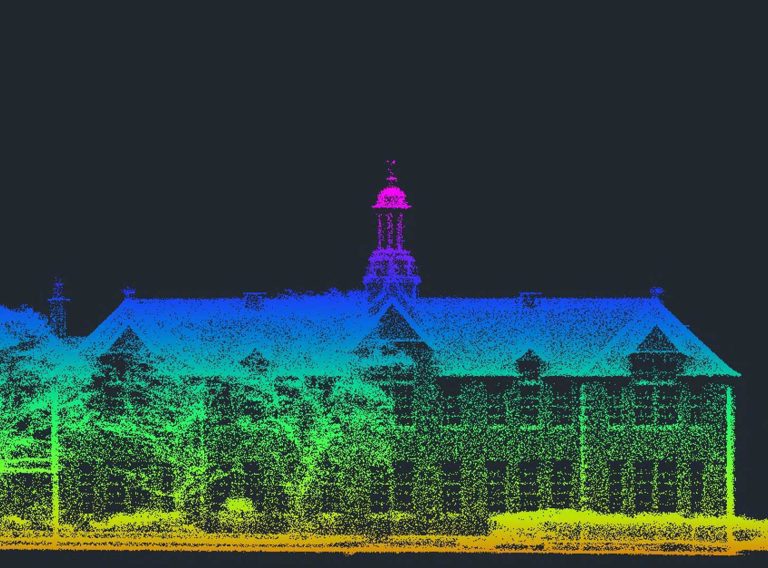
Receive highly accurate Revit® building models which ensure the success of your BIM (Building Information Model) project.
Revit models