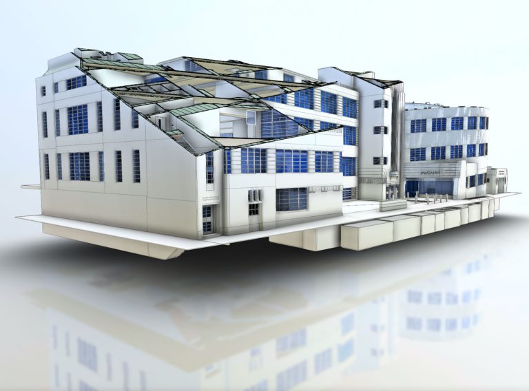
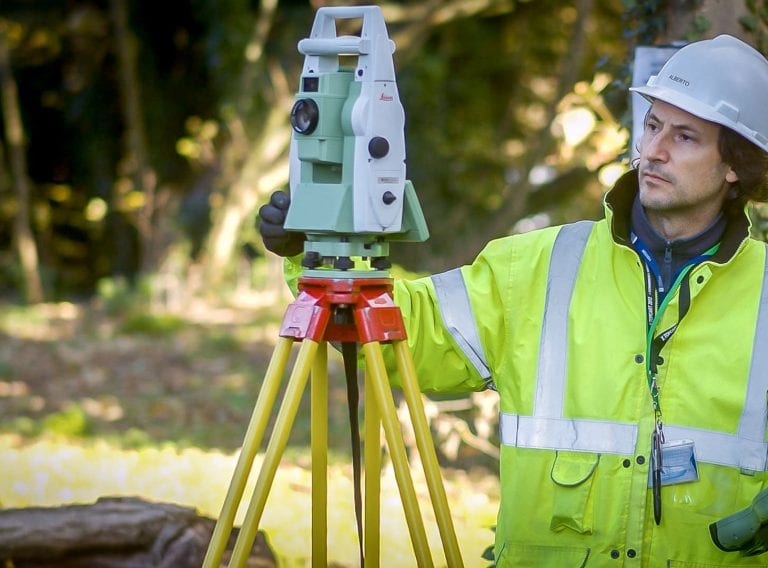
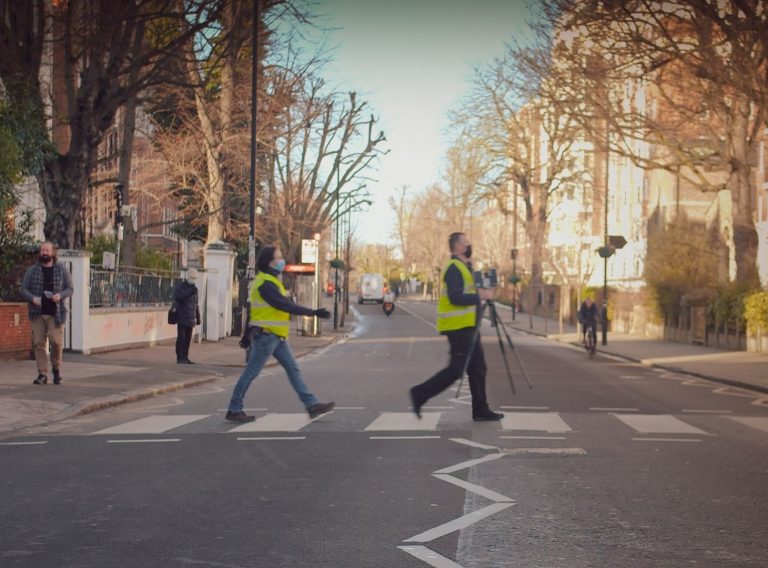
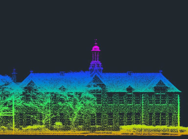
Achieve accurate results with our point cloud surveys and 3D laser surveys
Experienced surveyors will hone your laser or point cloud survey brief to ensure you get the information you need in the right format.
Laser surveys and point cloud surveysAwarded by The Royal Geographical Society, Chartered Geographer (CGeog) is the only internationally recognised professional accreditation for the use of geographical knowledge, understanding and skills in the workplace.
Image: The Royal Geographical Society
The Royal Geographical Society has approved less than 900 Chartered Geographer applications worldwide since 2002, making Iain one of a rare breed! Iain has been with CADS for 19 years, joining in 2001, was appointed Senior Surveyor in 2003, then Principal Surveyor in 2011 and received his Associate RICS qualification in 2017.
To be eligible for the certification, Iain needed a minimum of 10 years’ experience within a geographical related occupation, to have undertaken a range of geographical Continuing Professional Development (CPD) activities and hold Fellowship status within the society. He also had to create a professional career portfolio demonstrating how the Society’s Framework of Competencies are met within daily work activities and beyond. Iain also had to provide a three-year CPD log, examples of project work undertaken and two professional referees to corroborate the evidence. Iain has truly put in the work to receive this well-respected certification.
Working with specialist joinery contractor TMJ Interiors, CADS coordinated the project designs of all 70 contractors to create a federated Revit® model
Read case study All InsightsThe final step was a two-stage review, undertaken by an expert peer review panel with Assessors ensuring Iain’s application met the eligibility criteria and his professional achievements had been demonstrated to merit the award. Before the final approval was given at a meeting of the Society’s council in April.
Iain said:
‘’Achieving Chartered Geographer status provides me with a platform from which to demonstrate my experience, increase client trust and confidence through professional standards and allows me to promote the discipline with the backing of a professional accreditation.’’
I’d like to congratulate Iain on achieving this certification, it took hard work and commitment to his field whilst leading the CADS surveying team with utmost professionalism.
Experienced surveyors will hone your laser or point cloud survey brief to ensure you get the information you need in the right format.
Laser surveys and point cloud surveysReceive highly accurate Revit® building models from technical experts.
Revit building models