What is the difference between a GPS survey and GNSS survey?

CADS' Senior Geomatics and Surveying Engineer Alberto Embarba looks at the differences between a GPS survey and a GNSS survey and explains what this may mean to you to ensure your project requirements are met.
Scroll
When commissioning a Topographic Survey, clients often ask for a GPS survey, when they really mean a GNSS survey, but what is the difference, and why does it matter?
When creating a topographic survey brief, you can choose for it to be either a geo-referenced survey or a local survey. If your survey is geo-referenced, as we explain later, it is assigned a global location and therefore can be accurately used in conjunction with other forms of GIS data.
What is the difference between GNSS and GPS?
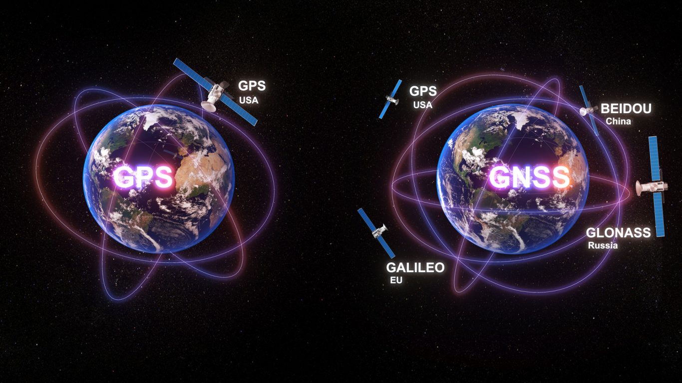
The GPS or Global Positioning System was originally developed by the U.S. Department of Defence in the early 70’s and was later released for civil use in the 80’s. It consists of a constellation of 24 satellites (NAVSTAR) plus backup, orbiting around the Earth and emitting coded signals containing navigation data in real-time. The receivers on the ground, or on planes or vessels, use the signals received from a minimum of 4 satellites to work out their location by ‘triangulation’. With the help of a GNSS receiver we can easily geo-reference our survey data into a specific coordinate frame.
A GNSS or Global Navigation Satellite System is a general term encompassing all navigation systems using satellite signals to calculate the position of a receiver. A GNSS survey can use one or more of the GNSS available today: GPS was just the first GNSS to be developed (US, first launched year 1978) but there are plenty more, like GLONASS (Russia, 1982), BeiDou (China, 2000), Galileo (EU, 2011), and many more under continuous development. Modern receivers are usually able to combine data from multiple navigation systems to increase the coverage and accuracy of measurement.
Satnavs vs Survey grade GNSS receivers
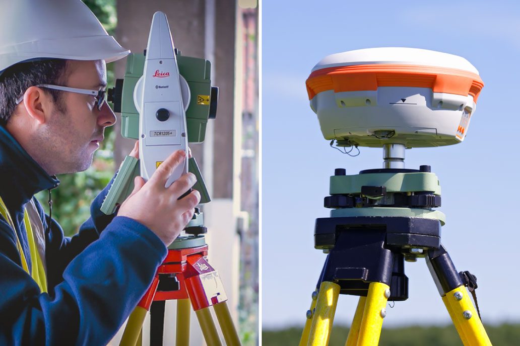
While your car’s SatNav does use the same signals as any survey grade GNSS receiver, they are only capable of reading the code emitted by the satellites, which gives a positioning accuracy of 5-10m.
Survey instruments, on the other hand, are much more sophisticated: they read the transmitted codes to get an approximate position but also measure and compare the carrier wavelengths to get the positional accuracy at a centimetre level. Hence, the difference in price… and size!

Discover GIS & asset mapping
Reduce costs, boost efficiency and create an accurate, up-to-date geo-spatial mapping record of all external property assets.
Create, maintain, update and analyse your asset information with our expert GIS & asset mapping services.
GIS & asset mappingLimitations of using GNSS in a survey
There are however two major limitations when using the GNSS in a topographic survey. The first limitation is that GNSS receivers need to get ‘clean’ signals from satellites and therefore do not work inside or near buildings or other structures. Any obstacles between the satellites and the receiver will block the signal or introduce a distortion that the receiver won’t be able to read, reducing the accuracy of the survey. This means they can only be used under open skies and can work partially in urban areas but never close to buildings or trees. However, they are not affected by the weather conditions in the same way the surveyors carrying them are!
In addition, using a single survey-grade GNSS receiver limits the accuracy of a survey, which can be improved by using two or more receivers in conjunction with a technique called differential correction. However this requires a link, normally via a mobile phone, to a reference station and therefore good mobile phone coverage is needed.
Radio links are possible in such cases, but they require an additional receiver used as a reference, plus some extra work on the registration when back in the office.

Better results from combining GNSS and TPS Surveys
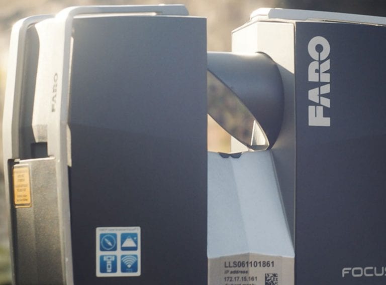
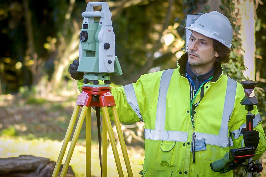
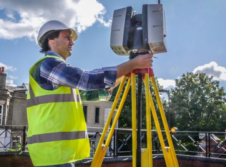
To overcome the limitations of GNSS surveys, Terrestrial Positioning Systems (TPS) can be used as a complementary solution. Leading this group are Total Stations, which represent the digital evolution of the old Theodolites, now capable of measuring not only angles but distances too.
Total Stations are opto-electronic devices built to the highest industry standards and can achieve accuracies of around a couple of millimetres in a single measurement. However they can only capture data that is visible from the instrument set up and therefore multiple setups are needed to cover wide areas, and consecutive setups are needed to keep a line of sight between them. This makes it a slow process when compared to GNSS surveys but can be very accurate if combined with the appropriate methodology.
Therefore, the best results can be achieved by combining both GNSS and TPS. Establishing permanent markers around the survey area and measuring them with both a GNSS receiver and a Total Station will allow us to transform our combined survey data into whatever coordinate system may be required in our project.
Establishing permanent markers around the survey area and measuring them with both a GNSS receiver and a Total Station will allow us to transform our combined survey data into whatever coordinate system may be required in our project.
Why geo-reference a survey?
As mentioned at the start of this article, a topographic survey can be either geo-referenced or locally referenced.
While local arbitrary coordinate systems may be used for surveys when there is no need to connect the data to that of a different source or put it in a greater context, in many cases, there will be a benefit in geo-referencing the spatial data: for example, when the survey data needs to be used in conjunction with a previous survey or maybe a future one.
Geo-referencing relates to the transformations applied to a dataset so it can be represented within a specific geographic coordinate frame.
There are multiple coordinate systems out there and choosing a relevant one for a survey is key for coordination purposes and in many cases, it’s simply a pre-set requirement.
When selecting a system on which to geo-reference the options are:
- A project-specific coordinate systemlarge construction sites and other places of sensitive nature where dimensional control is paramount usually establish their own reference frames, which may or may not be linked to a national or global system.
- A national reference systemMost countries have adopted at least one official coordinate frame that suits their region best. For example, the OSGB36 National Grid is the official reference system for Great Britain, with heights relating to the Ordnance Datum Newlyn. The Irish National Grid was adopted by both Ireland and Northern Ireland, with heights relating to the Malin Head datum for Ireland and to the Belfast datum for Northern Ireland.
- A global reference systemLike the ETRS89, used for coordination across the whole region of Europe, or the WGS84, which is a worldwide reference system used natively by GPS satellites and receivers, and widely adopted by most GNSS.
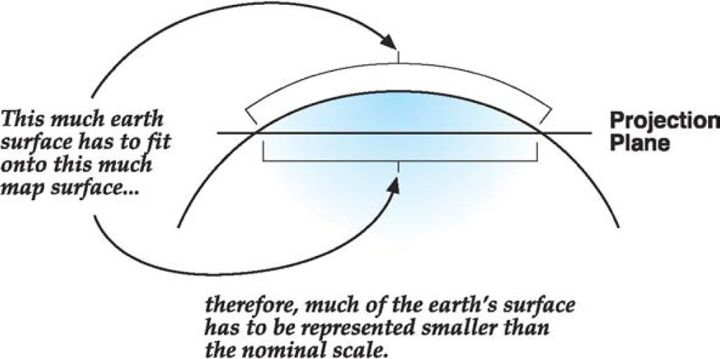
What is a map projection and why is it needed?
GNSS receivers use ellipsoids as mathematical approximations of the Earth’s surface. That way, the position of any point in the world can be represented in a global coordinate system in geodetic format (longitude, latitude and ellipsoidal height) on that ellipsoid. However, geodetic coordinates must be transformed before they can be represented on a local map. A transformation will usually involve a datum change, some shifts, rotations and a map projection, which is a mathematical projection of the survey data from a three-dimensional ‘curved’ surface onto a flat map. However, while this data transformation can be automated within the GNSS receiver settings and this happens seamlessly between systems in real time, specific transformations with appropriate map projections are designed for specific purposes. Therefore, it is important to discuss how you intend to use your data with your surveyor to ensure the correct transformation and map projection is applied and your data is ultimately accurate and fit for purpose.
Image credit: Understanding Map Projections – GIS by ESRI™
In summary
To summarise, when commissioning a topographic survey it is most likely that you will be commissioning a GNSS survey in conjunction with a TPS survey to obtain the data you need that meets your project requirements. The technical considerations required to deliver the data accuracy and ability to use in conjunction with other data sources are the reasons you employ a professional surveyor. So do make sure you discuss your project needs in detail when defining the scope of your survey.
Related Content
Editor's picks

 05/06/2020
Insights
05/06/2020
Insights