Get accurate results with our 3D laser and point cloud surveys
Our highly experienced surveyors will conduct 3D laser or point cloud surveys to ensure you have all the spatial information and 3D modelling you need.
3D laser surveys
Scroll

Laser surveys enable you to measure a physical environment and generate high-precision data which can be used to create 3D models which are used by architects to design and refurbish spaces.
For a complex and time-critical project, laser surveys are popular amongst architects, project managers and construction professionals due to their speed and the high level of detail they provide.
So, we’ve had a look at the advantages of laser surveys and why they are the space measuring tool of choice for many different industries.
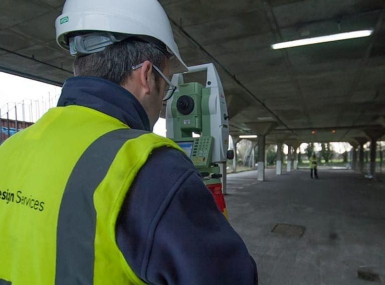
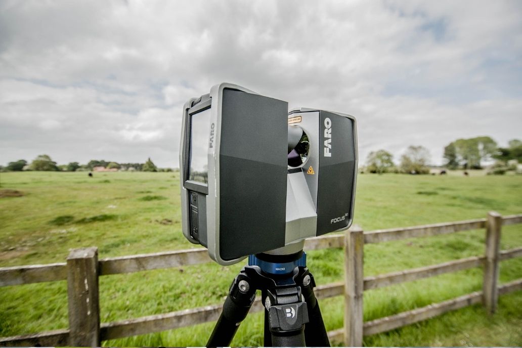
Laser surveys are a process by which spatial detail is captured using high-tech three-dimensional (3D) laser scanners.
A laser scanner is methodically placed within the space to be surveyed. It scans all objects in the room, building or area and gathers the full perspective of the space.
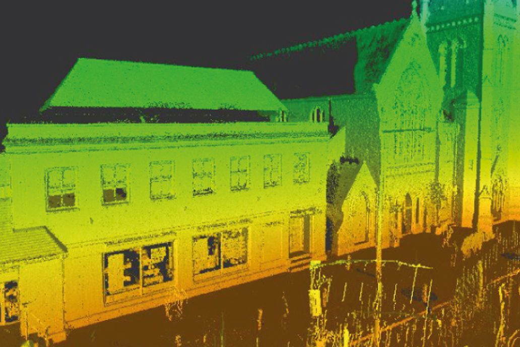
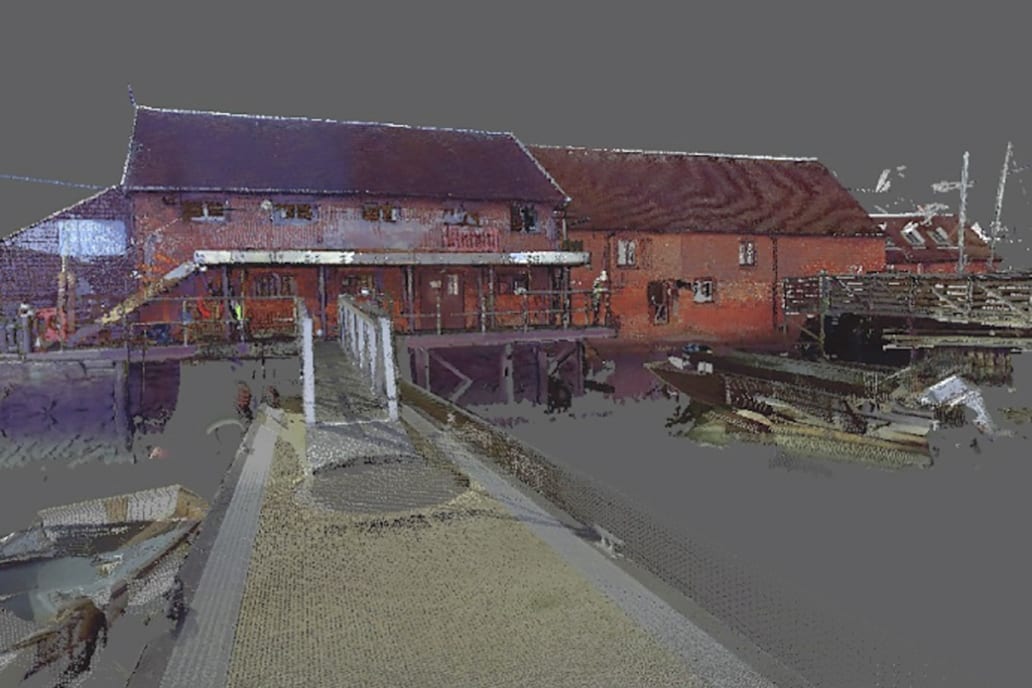
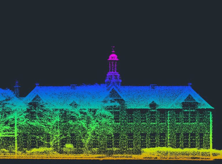
High definition (HD) laser scanners record angles and distances through analysis of returned laser light signals as they bounce back from surfaces. Each signal creates a ‘point’ in 3D space, which combine to form a ‘point cloud’.
As the space is scanned, the survey captures data in the form of a point cloud which is then registered to create a 3D model.
There are two main types of laser scanner used in 3D laser surveys, which operate in two different ways:
Get the data you need for your project – in the right format, at the right level of detail.
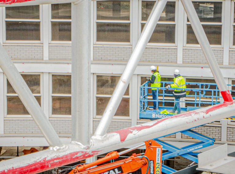
Laser SurveysLaser surveys are most often used by construction and spatial design teams.
The data generated by laser scanning can be used by construction professionals to understand the space and identify the freedom or constraints which will impact their project.
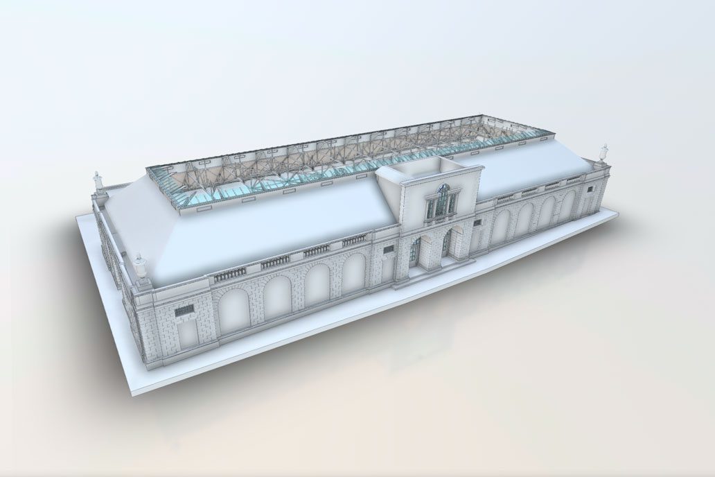
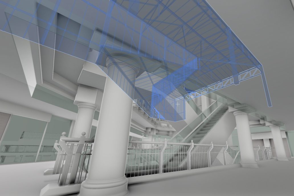
Often, laser surveys are used as part of a wider planning process. The data from laser surveys is registered as a point cloud, from which a 3D Revit model can be generated. These are dimensionally accurate, helping visualise the space and facilitate the design process.
The base model is edited within the Revit software, where existing elements can be retained or removed, alongside the new design proposals.
Laser surveys can also be used to facilitate Business Information Modelling (BIM) processes, allowing architects to see a construction project develop throughout its life cycle.
The laser survey provides accurate existing information early on in the BIM process. This information is enhanced by architects and design teams throughout the construction process. Once complete, the model is effectively a digital twin of the constructed project, which can be handed over to the client and used for facilities management planning.
Laser surveys capture highly accurate data at rapid speeds.
The laser scanner records millions of data points in mere seconds, ensuring large environments can be surveyed quickly. This is ideal for time-sensitive projects.
The speed of laser scanning is one important reason why it is becoming so widely utilised in a diverse range of industries.
Laser surveying can be used to scan hard-to-reach areas. This is ideal for more complex spaces, in which certain objects may be obscured or otherwise difficult to reach, such as ceiling voids.

Another advantage of laser surveys is that they do not require contact with the existing structure to capture data. This is great for situations in which there are potentially fragile or sensitive objects or environments. For example, in cultural or heritage settings in which preservation is key.
By using laser scanning, laser surveys are a non-invasive method of gathering high-detail data.
Often, laser surveys are used as part of a wider planning process. The data from laser surveys is registered as a point cloud, from which a 3D Revit model can be generated. These are dimensionally accurate, helping visualise the space and facilitate the design process.
In construction, renovation and refurbishment, laser surveys are helpful in understanding the architectural landscape being worked on.
The high speed at which laser surveys are conducted is ideal for time-critical projects. 3D scanning allows more freedom and creativity when creating construction plans and designs.
However, laser surveys can be used in a wide range of industries.
From creating optimal flow in a bus station or supermarket, to ensuring smooth movement through a museum, laser surveying has become a vital tool in creating 3D models which help architects design spaces.
At CADS, our team of measured surveyors offer 3D laser scanning to help you understand your space and create 3D Revit models to help you get the best from it.
We also deliver retail spacing solutions, helping brands plan the internal layout of their stores to maximise customer experience and boost sales.
Our highly experienced surveyors will conduct 3D laser or point cloud surveys to ensure you have all the spatial information and 3D modelling you need.
3D laser surveys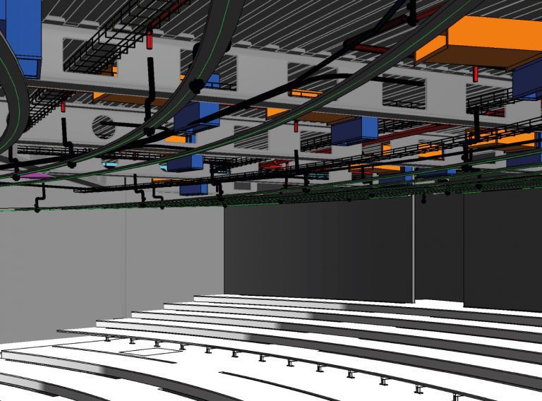
Acquire an accurate base model for BIM projects for architects to use as the foundation for designs.
BIM surveys