Drone land surveys
Map the natural physics and features across vast sites with a fast and cost-effective UAV drone survey from CADS.
Drone land surveys
As one of the UK’s leading suppliers of survey solutions, we’ve taken a look at the applications of drone surveys for you as a landlord or estate manager – and the top three reasons you should commission one for your next project!
Scroll
As a landlord or estate manager, you manage the upkeep and maintenance of your properties. This can be a daunting task, especially if you have a large portfolio of assets.
Drone surveys can be a valuable tool for you as they provide a comprehensive overview of your properties – without the need for scaffolding or other expensive methods of accessing your land or property.
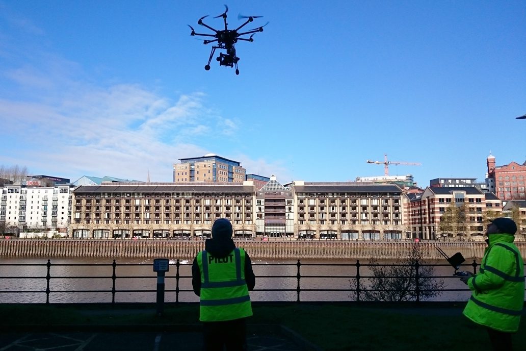
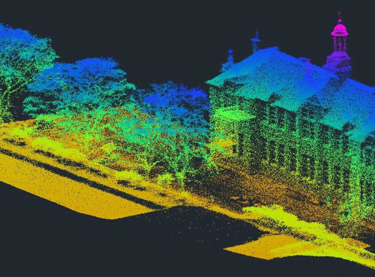
Drone land surveysUnmanned aerial vehicles (UAVs) – most commonly referred to as drones – are becoming more popular in the surveying industry!
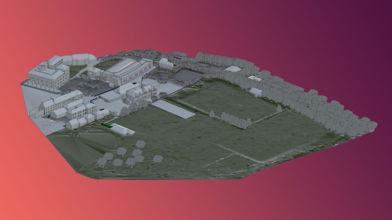
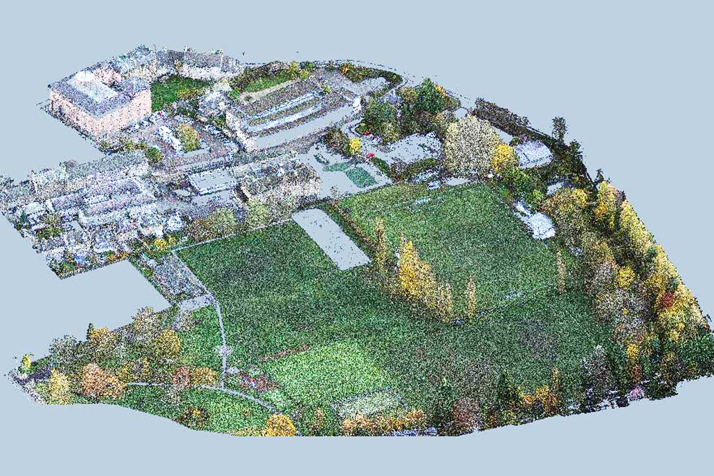
They use a LiDAR (light detection and ranging) scanner and attached sensors to collect dimensionally precise aerial point cloud data, while capturing pictures of the ground below to provide an exact representation of the area.
Drone surveys are incredibly valuable for many projects as a quick way to obtain accurate data of both accessible and inaccessible areas without causing too much disruption – and they’re cost effective too!
With a wide range of both 2D and 3D deliverables which can be produced from the data, drone surveys are extremely versatile for a range of needs.
There are a number of different drone surveys which can be undertaken for landlords and estate managers. Some of the most common types include:

Drone surveys offer a number of benefits which make them a valuable tool for a variety of purposes. Here’s three reasons why we think you should commission one:
One
The accurate data from the drone survey can be used to inform RIBA Stage 6 – Handover, Stage 7 – Use, and Post-Occupancy Evaluations (POE).
This means that you can utilise them to assess the progress of a construction, identify potential problems and review the condition of a building after it’s been completed.
Two
They can be used to quickly and efficiently collect data from large areas including brownfield and greenfield sites. This can be done without the use of scaffolding or other access methods – which saves you time and money!
Three
UAV surveys reduce the disruption to your tenants, employees, pedestrians, commercial customers and traffic.
Drone surveys are great for a wide variety of uses in your industry and no matter what you commission them for, they offer extremely useful data.
This can be in the form of imagery, video, or point cloud data, or a range of other deliverables – whichever suits your needs best!
Accurate surveys are invaluable for planning your operations in a cost-effective and efficient manner.
Here at CADS, our aerial drone survey team work alongside your building project team to bring you accurate and reliable data.
With over 35 years’ experience, our expert team of surveyors have conducted efficient and effective surveys for a diverse selection of clients in variety of sectors.
Get in touch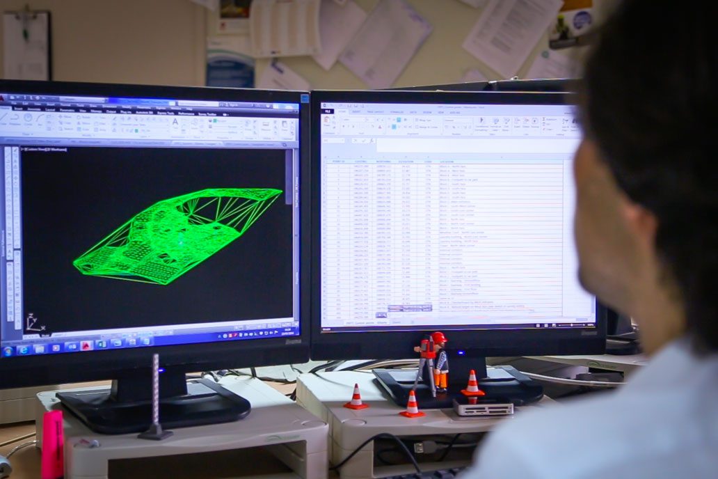
Map the natural physics and features across vast sites with a fast and cost-effective UAV drone survey from CADS.
Drone land surveys